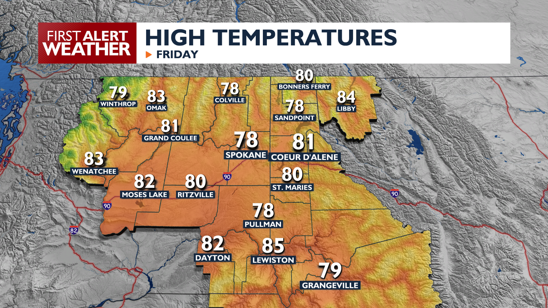
Friday is going to be noticeably cooler as afternoon temperatures only reach the upper 70s to around 80. Expect breezy conditions during the afternoon hours with gusts up to 20 mph that will temporarily blow away most of the smoke hanging around the area. Conditions remain dry Friday, but cloud cover will begin to increase as a weather system approaches.
Saturday marks a significant pattern change as high temperatures drop into the low 70s and wind gusts increase to 30 mph. Mountain thunderstorms are possible Saturday afternoon with a 20 percent chance of rain in the northern mountains. By Sunday morning, sheltered valleys in the north could see temperatures plunge into the mid-30s, leading to potential frost formation. Temperatures in Spokane and Coeur d’Alene will dip into the 40s for Sunday and Monday mornings.
While rain is unlikely for many places this weekend, our fortunes could change next week. Another weather system will keep us cool and keep showers in the forecast for midweek.
COPYRIGHT 2026 BY KXLY. ALL RIGHTS RESERVED. THIS MATERIAL MAY NOT BE PUBLISHED, BROADCAST, REWRITTEN OR REDISTRIBUTED.