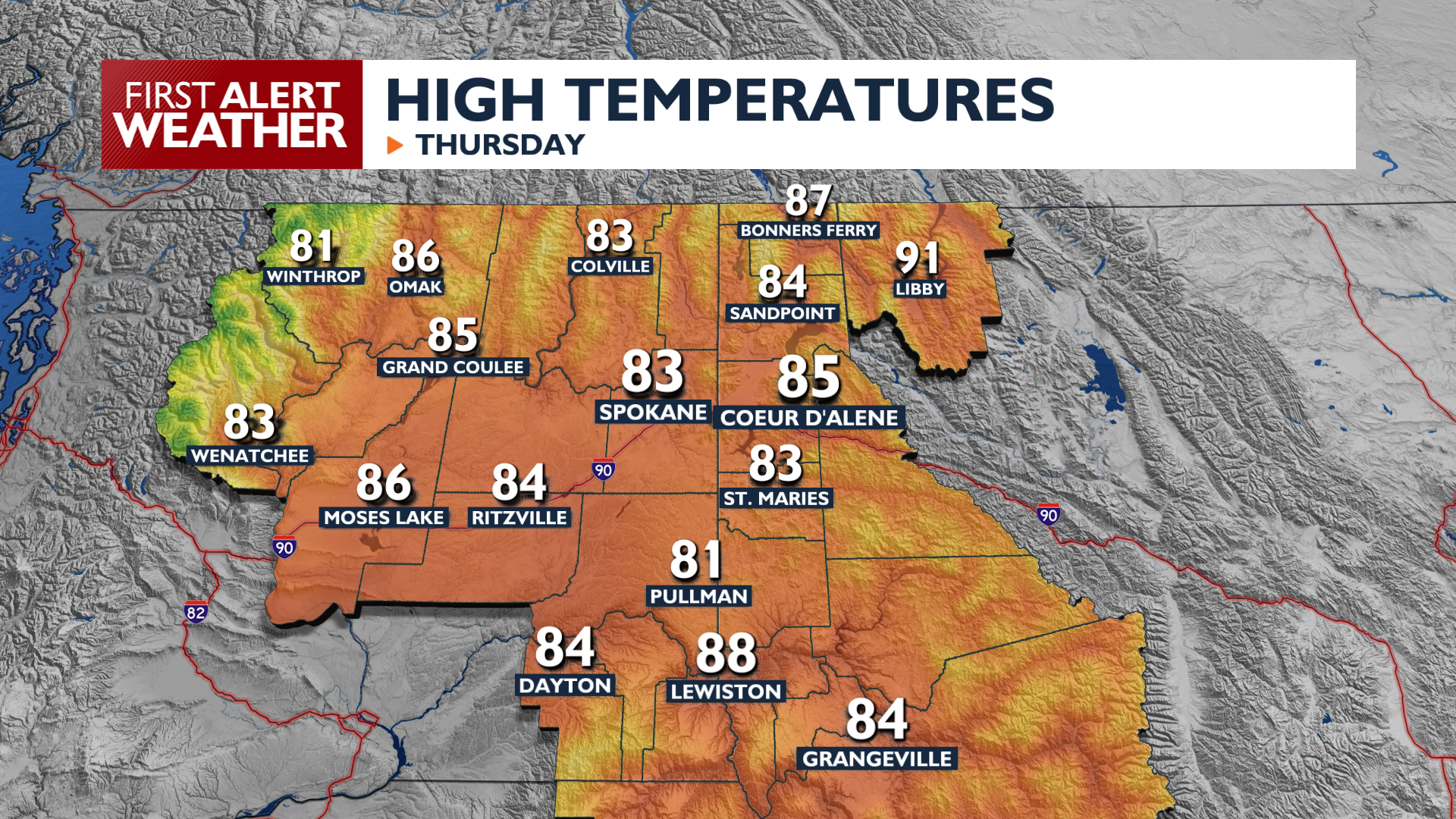
Clouds and haze this morning will give way to breezy and sunny weather for Thursday afternoon.
A cold front crosses the region Thursday, bringing breezy southwest winds between 10 and 25 mph with gusts reaching 35 mph. High temperatures will reach the low to mid 80s, which is about 10 degrees cooler than Wednesday.
A Red Flag Warning is in effect from noon to 8 PM Thursday for the Okanogan Valley and Waterville Plateau due to these elevated fire weather conditions. Other areas of the Inland Northwest should be alert as well since new fires will spread faster in these winds and dry environment.
The cooling trend continues into the weekend with highs dropping into the 70s. A stronger system arrives Saturday, bringing a chance for mountain showers and thunderstorms to northern Washington and the Idaho Panhandle. Significant rainfall is unlikely. Temperatures over the weekend will be quite cool in the mornings, possibly even in the 30s for a few sheltered northern valleys.
COPYRIGHT 2026 BY KXLY. ALL RIGHTS RESERVED. THIS MATERIAL MAY NOT BE PUBLISHED, BROADCAST, REWRITTEN OR REDISTRIBUTED.