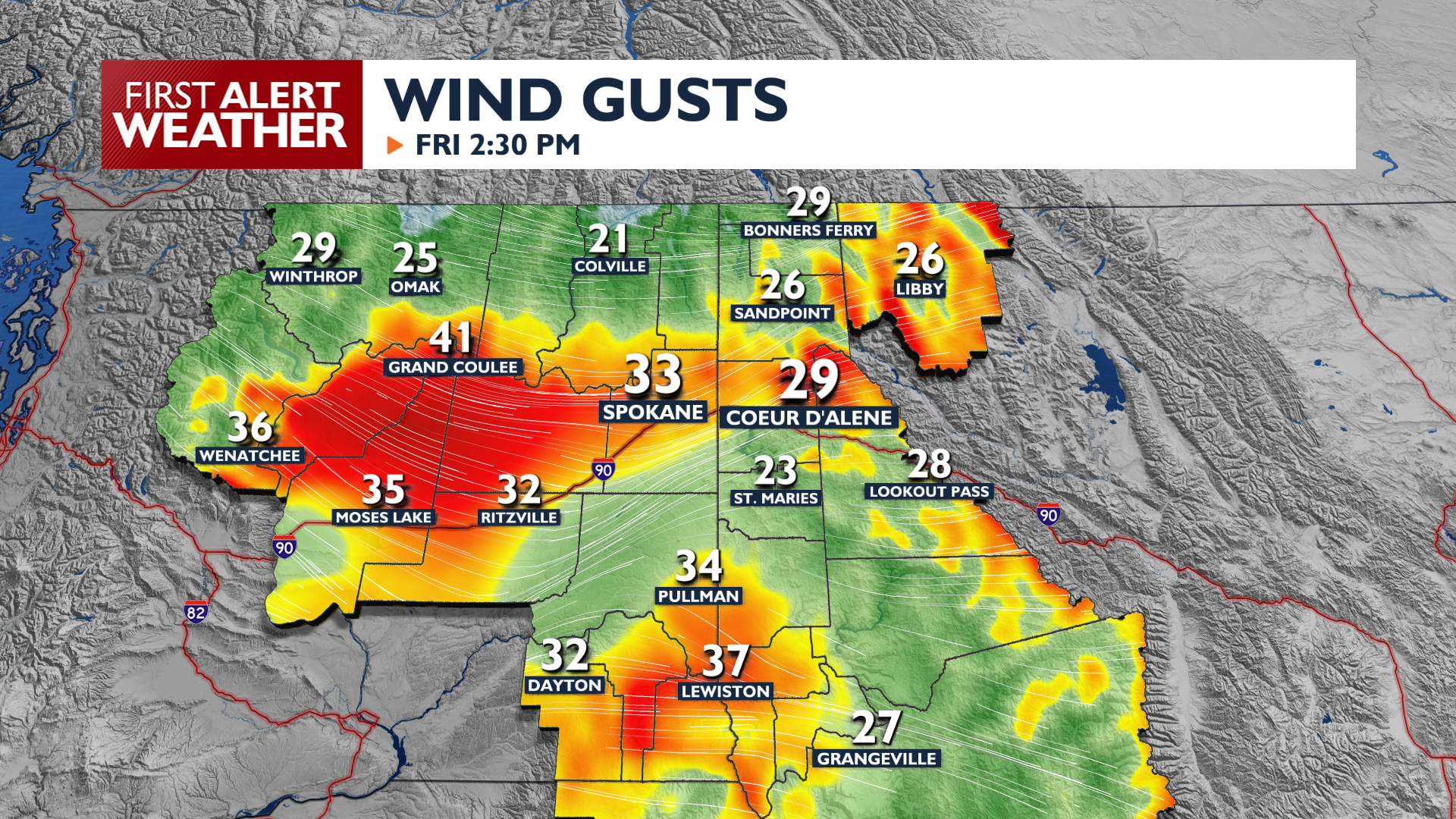
Thursday is our last afternoon of unseasonably warm and dry weather before a strong cold front arrives Friday with gusty winds, a sharp temperature drop, and chances for rain and mountain snow.
High temperatures will climb into the 70s for one final day today. Cloud cover will begin to increase as the colder air begins to creep closer to the Inland Northwest.
Thursday night will be quiet and dry with overnight lows dropping into the upper 40s and low 50s. A significant weather shift begins Friday as a cold front brings rain showers followed by gusty winds between 35 and 45 mph. These winds may cause blowing dust and isolated power outages through Friday Night.
Much colder air follows this weekend, with high temperatures only in the 50s and lows in the 30s. Snow levels will drop as low as 4,500 feet Saturday morning, bringing up to 2 inches of snow to mountain areas in North Idaho. Temperatures drop further on Sunday night, with a chance for our first widespread freeze of the fall on Monday morning.
COPYRIGHT 2026 BY KXLY. ALL RIGHTS RESERVED. THIS MATERIAL MAY NOT BE PUBLISHED, BROADCAST, REWRITTEN OR REDISTRIBUTED.


