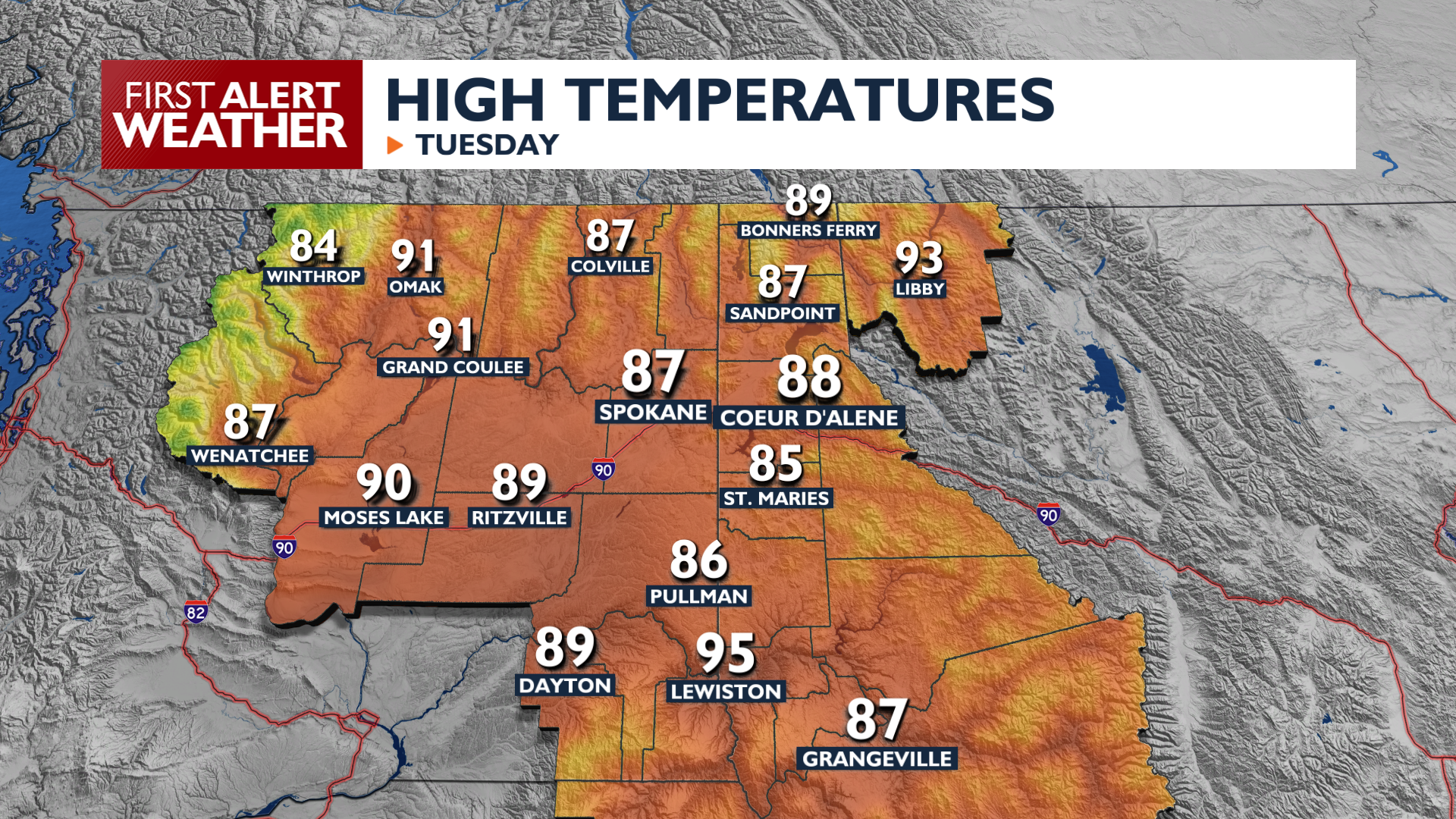
Fire danger goes up a notch this afternoon as gusty winds swing through the Inland Northwest.
Plan Your Tuesday
A dry cold front moves through the Northwest this afternoon, bringing gusty winds and low humidity. Spokane will see another day in the upper 80s with wind gusts reaching 25 miles per hour. While no formal fire warnings are in effect for Tuesday, any new ignitions could spread rapidly due to the dry air and elevated wind speeds.
Wildfire smoke will be noticeable, but will not be a major issue for the I-90 corridor during the day. Overnight, winds shifting behind the front will bring in some smoke from the fires in Northeast Washington. This will lower air quality for early Wednesday morning.
What We’re Tracking
Temperatures stay fairly steady, slowly warming into the 90s by Friday. The most significant weather concern arrives Saturday as a stronger front brings critical fire weather conditions. Wind gusts of 30-plus miles per hour are expected across the region, with a 30 percent chance of gusts exceeding 50 miles per hour in Central Washington. Temperatures will drop significantly behind this weekend front, with highs only in the upper 70s a possibility for Sunday.
Extended Forecast
COPYRIGHT 2026 BY KXLY. ALL RIGHTS RESERVED. THIS MATERIAL MAY NOT BE PUBLISHED, BROADCAST, REWRITTEN OR REDISTRIBUTED.