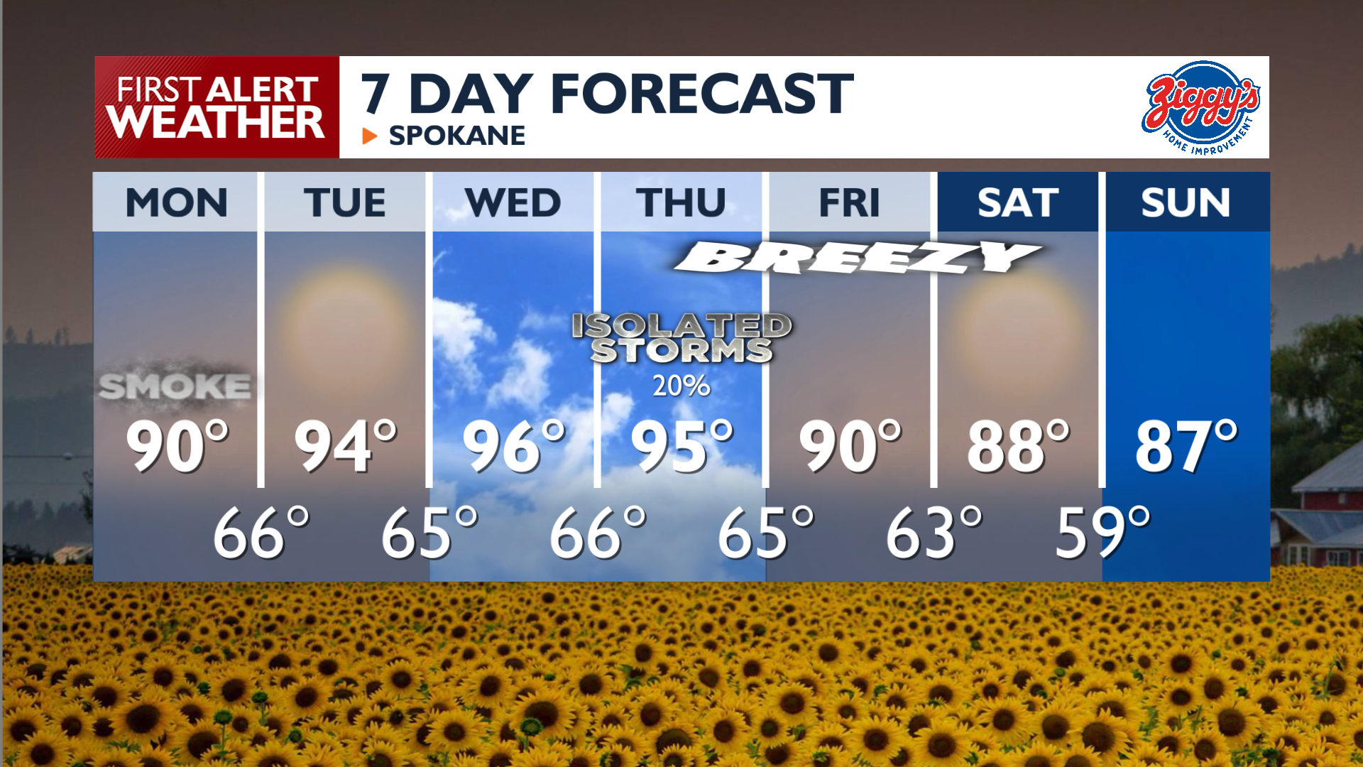
A warming trend is on the way, but smoke may undercut those highs as we continue to track poor air quality in the Inland Northwest.
Plan Your Day
Monday features hazy skies and smoke moving into the Spokane area from the Kaiser Canyon and Modrite fires on the Colville Reservation. Northerly winds will shift smoke across the region throughout the day, moving smoke from the northern mountain valleys into the I-90 corridor for midday and then pushing it back north overnight. Expect afternoon highs to reach the upper 80s to mid-90s across the region. Continue to monitor air quality and be ready to limit how much time you spend outside if the AQI drops into the Unhealthy range.
What We’re Tracking
Smoke will continue to be an issue at times throughout the week, which may limit how high our latest warming trend may go. The potential is there for upper 90s to around 100 degrees on Wednesday and Thursday, but the smoke can cut a few degrees off of those highs. Also on Thursday, thunderstorms and gusty winds re-enter the forecast, followed by a few days of afternoon breezes out of the southwest. Extreme wildfire activity in Oregon will likely bring more smoke our way to end the week and begin next weekend.
Extended Forecast
COPYRIGHT 2026 BY KXLY. ALL RIGHTS RESERVED. THIS MATERIAL MAY NOT BE PUBLISHED, BROADCAST, REWRITTEN OR REDISTRIBUTED.


