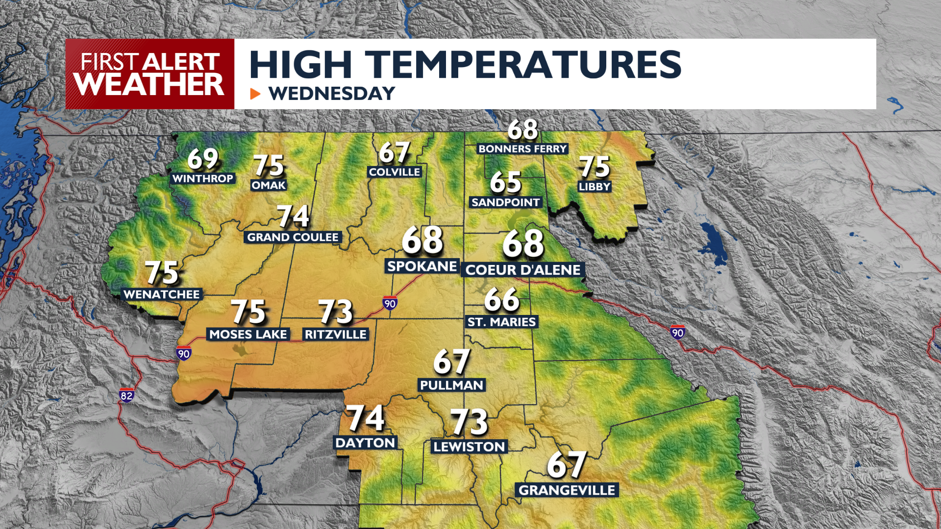
Active weather returns Wednesday with widespread rain showers and isolated thunderstorms this morning, followed by gusty winds and cool temperatures this afternoon.
Rain chances increase as Wednesday morning goes on, with some showers lingering into the afternoon. Highs will reach the 60s and low 70s. Winds this afternoon will gust 20 to 40 mph, potentially causing blowing dust in the Columbia Basin and difficult travel conditions.
Another round of scattered showers is expected Wednesday night into Thursday morning. These two waves of wet weather are the most likely times this week to pick up some rain in Spokane and Coeur d’Alene, though a passing shower will remain possible for the rest of the week.
Temperatures will be chilly in the mornings heading into Labor Day Weekend with 30s and low 40s as early as Friday morning. Rain chances will continue through the weekend, though mostly at night or in higher elevations while temperatures warm to the 70s for afternoon highs.
COPYRIGHT 2026 BY KXLY. ALL RIGHTS RESERVED. THIS MATERIAL MAY NOT BE PUBLISHED, BROADCAST, REWRITTEN OR REDISTRIBUTED.