Wednesday will be a cooler, wetter, and breezier day as an incoming storm sets us up for some chillier temperatures to end the month.
Temperatures turn cooler as a low-pressure system brings rain to the valleys and snow to the mountains. Highs today will only reach the upper 40s at warmest.
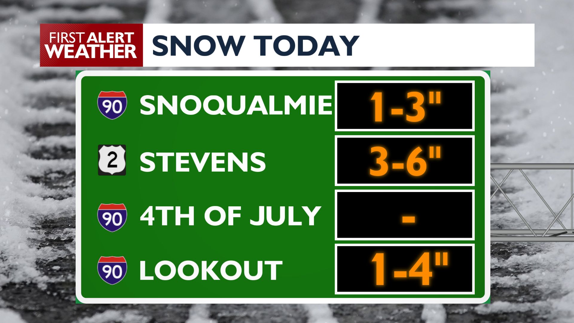
A Winter Weather Advisory is in effect for the Cascades above 3000 feet until 5 PM Wednesday. Slushy snow is likely over Snoqualmie, Sherman, and Lookout Passes while Stevens Pass will see the heaviest snow (4-8″). Southwest winds will gust between 15 and 25 mph throughout Wednesday morning, adding to the chilliness of the day.
Moisture lingers Wednesday night into Thursday while temperatures fall to within a few degrees of freezing on Thursday morning. Spotty showers during this time could produce a mix of rain and snow in our northern valleys. Our weather begins to dry out beyond Thursday morning, though isolated showers will remain possible through Saturday night.. Dry weather and warmer temperatures start to stabilize things by the end of the weekend.
COPYRIGHT 2026 BY KXLY. ALL RIGHTS RESERVED. THIS MATERIAL MAY NOT BE PUBLISHED, BROADCAST, REWRITTEN OR REDISTRIBUTED.