Cool and showery days are ahead through Labor Day Weekend as temperatures stay below normal for early September.
After a rainy night, it will be a drier Thursday with only widely scattered showers and isolated thunderstorms. Expect breezy conditions in central Washington with southwesterly gusts up to 20 mph and high temperatures reaching the 60s to low 70s.
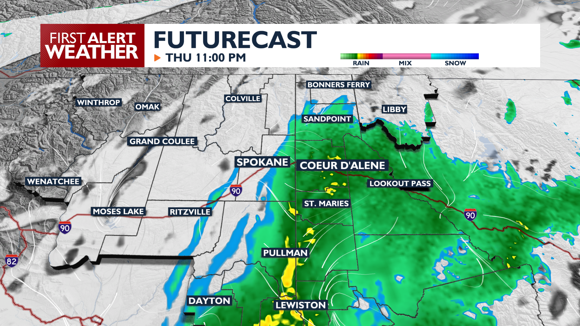
Thursday Night brings a renewed chance for rain across southeast Washington and the Idaho Panhandle as temperatures drop into the 40s and even upper 30s in a few select areas. There’s a scenario where we see considerable rainfall in Coeur d’Alene and around the Palouse tonight, while Spokane and Northeast Washington see very little rain, if any.
Friday brings more opportunities for showers and storms, particularly near the mountains and in southeast Washington. Friday Night and Saturday morning will be chilly. Clearing skies could lead to patchy frost in a few northern valleys as lows dip into the mid-40s to mid-30s. Over the Labor Day weekend, the highest rain chances will be on Saturday morning and Sunday night into Monday morning.
COPYRIGHT 2026 BY KXLY. ALL RIGHTS RESERVED. THIS MATERIAL MAY NOT BE PUBLISHED, BROADCAST, REWRITTEN OR REDISTRIBUTED.