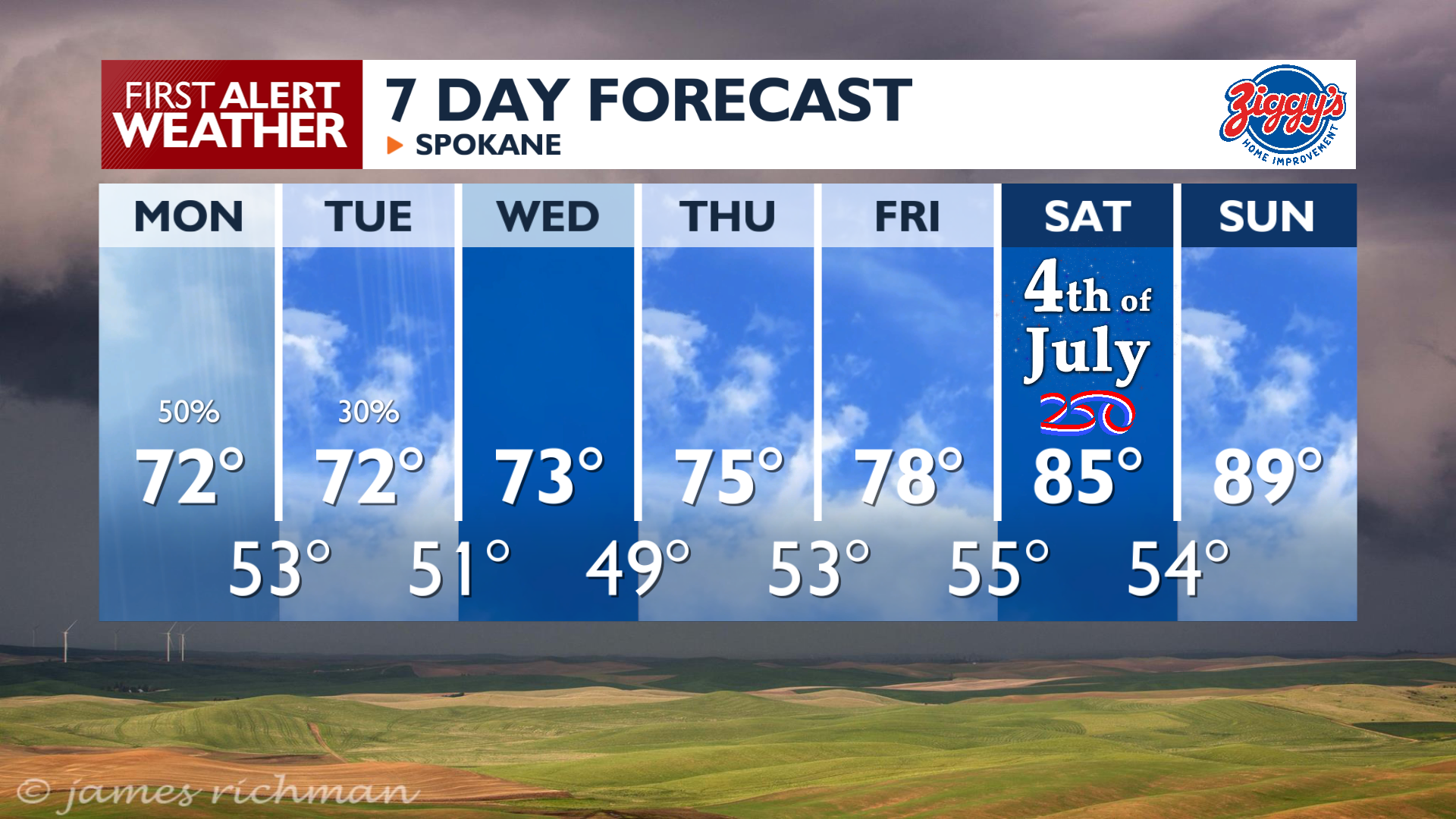
We’ve got another day of showers and storms in the forecast with some improvements as we get closer to July 4th.
Plan Your Monday
Monday brings more wet weather, with a chance of thunderstorms in the afternoon and evening. Storms may produce small hail, lightning, and heavy downpours, especially in the northern mountains. High temperatures will be a little warmer than on the weekend, but still below normal in the 70s.
What We’re Tracking
Showers continue through the night into early Tuesday before we start drying out. After a cool and relatively dry middle of the week, a significant warming trend arrives for the holiday weekend. It’s looking like a great Independence Day with highs in the 80s. By Sunday, temperatures climb into the high 80s and low 90s with another weather system in the area, which brings some doubt to conditions for the end of the weekend this far out.
Extended Forecast
COPYRIGHT 2026 BY KXLY. ALL RIGHTS RESERVED. THIS MATERIAL MAY NOT BE PUBLISHED, BROADCAST, REWRITTEN OR REDISTRIBUTED.