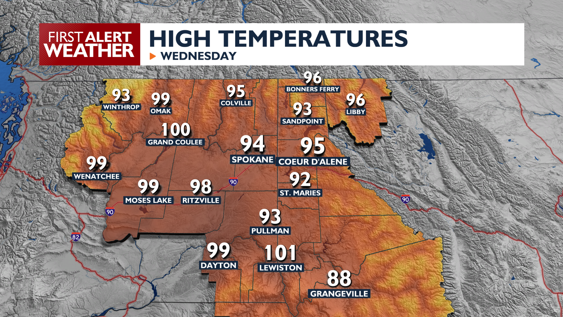
A combination of intense heat and potential thunderstorms will make things more difficult as you go about your day.
Plan Your Wednesday
Afternoon temperatures will be sizzling and one of our hottest days so far this summer in the middle to upper 90s. A few low 100s are possible around the Columbia Basin. Isolated thunderstorms are possible late this afternoon in the Cascades and Okanogan Highlands.
Thunderstorm chances increase tonight in Eastern Washington, with mostly dry storms lasting into the early morning hours. Lightning could start new fires, which is why a Fire Weather Watch is in effect for the Cascades and Columbia Basin.
What We’re Tracking
The risk of stronger thunderstorms increases Wednesday night into Thursday. These storms could produce hail and gusty winds, especially on Thursday afternoon. A Fire Weather Watch is in effect for much of Central Washington starting Wednesday night due to the threat of dry lightning.
It will also be a very hot day on Thursday, with upper 90s and low 100s in many areas. Following the storms, a drying trend begins Friday with slightly cooler temperatures. Triple-digit heat could return by Monday.
Extended Forecast
COPYRIGHT 2026 BY KXLY. ALL RIGHTS RESERVED. THIS MATERIAL MAY NOT BE PUBLISHED, BROADCAST, REWRITTEN OR REDISTRIBUTED.