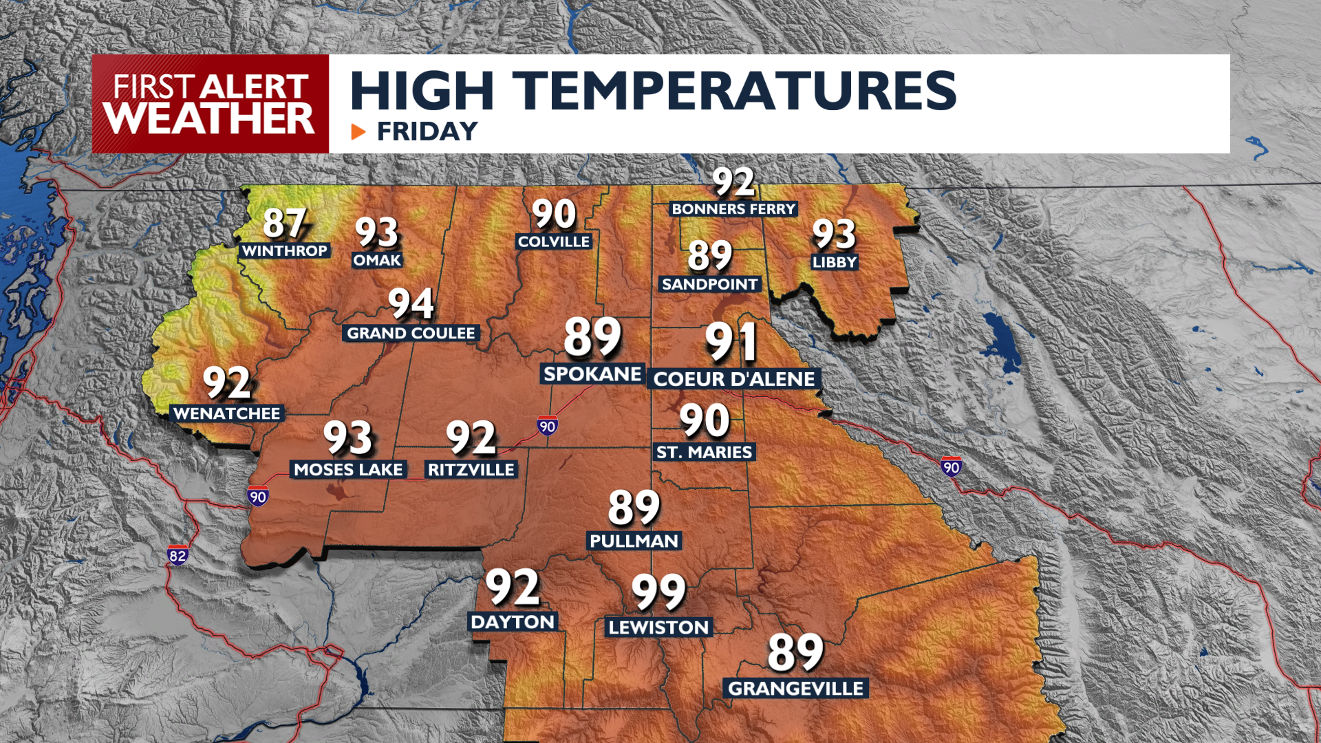
We’re heating up again on Friday with some winds to open the weekend and keep fire danger elevated for the next 48 hours.
Plan Your Friday
Friday will be warmer than Thursday, hitting the upper 80s and low 90s around Spokane with middle 90s in the Columbia Basin. Breezy west winds will develop through the Cascade gaps during the afternoon and evening. Relative humidity remains low, which, combined with the wind, increases the risk of fast-spreading fires in Central Washington.
There is a small 10 to 15 percent chance for isolated sprinkles or a stray thunderstorm Friday night into early Saturday morning across the Idaho Panhandle and far Eastern Washington.
What We’re Tracking
A Fire Weather Watch is in effect for Saturday afternoon and evening for the Okanogan Valley. Southerly winds will channel through the valleys, increasing the risk of extreme fire behavior. Fire risk will drop on Sunday as winds calm. Highs over the weekend will be cooler, in the mid-80s.
Next week appears to be an impactful one with both heat and the possibility of thunderstorms. Building heat east of the Rockies will help bring in moisture to the Inland Northwest. Combined with the heat, thunder will be a possibility midweek with highs in the low to mid 90s.
Extended Forecast
COPYRIGHT 2026 BY KXLY. ALL RIGHTS RESERVED. THIS MATERIAL MAY NOT BE PUBLISHED, BROADCAST, REWRITTEN OR REDISTRIBUTED.