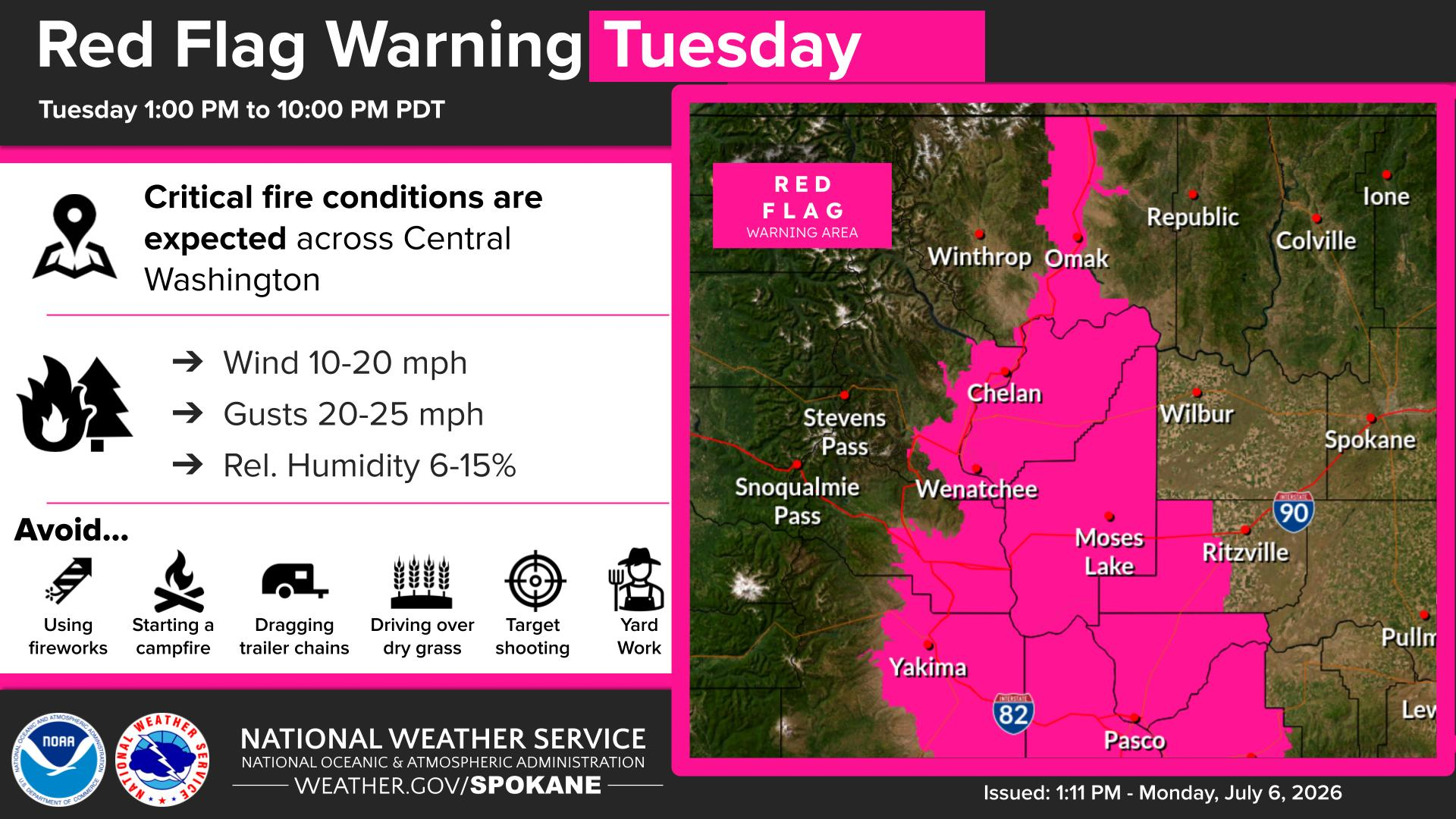
Tuesday brings the hottest temperatures of the week along with critical fire weather conditions. A Red Flag Warning is in effect for several areas today with more coming tomorrow.
Plan Your Tuesday
Tuesday will be the hottest day of the week as temperatures climb into the mid to high 90s across the Inland Northwest. These temperatures are nearly 10 degrees above normal, making today difficult for people without a way to stay cool. By Tuesday afternoon, winds in the Cascade gaps will increase to 30 mph, triggering a Fire Weather Warning for the Okanogan Valley and Western Columbia Basin through 10 PM tonight.
What We’re Tracking
A dry cold front arrives Wednesday morning, bringing even stronger winds with gusts between 35 and 45 mph. A widespread Red Flag Warning will be in effect from 11 AM to 10 PM Wednesday for much of central and eastern Washington. Although this is a dry front, there is a 10 percent chance of dry thunderstorms tonight and early Wednesday morning, which could serve as an ignition source for new fires if we get unlucky.
Extended Forecast
COPYRIGHT 2026 BY KXLY. ALL RIGHTS RESERVED. THIS MATERIAL MAY NOT BE PUBLISHED, BROADCAST, REWRITTEN OR REDISTRIBUTED.