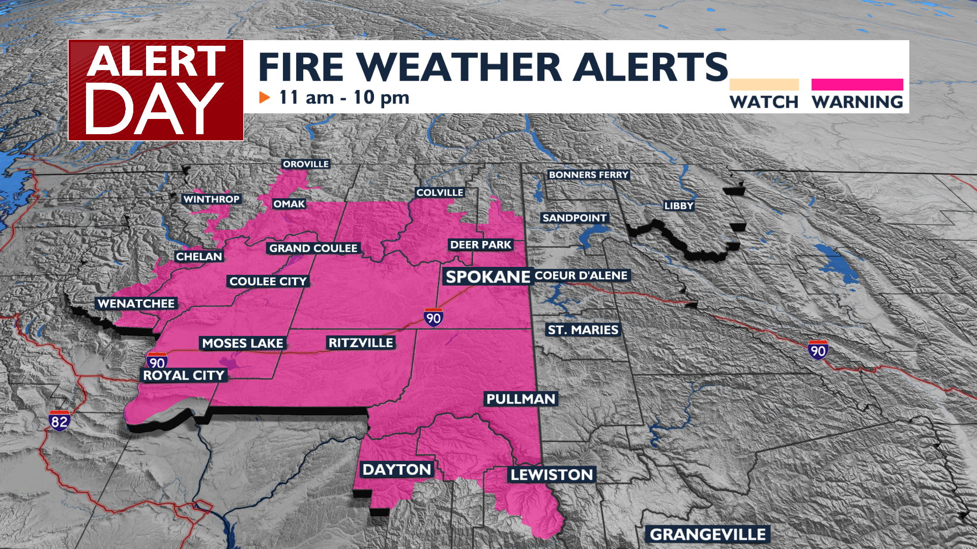
A cold front moving through the region has brought lightning strikes to the Inland Northwest this morning and will create critical fire weather this afternoon with strong gusty winds.
Plan Your Wednesday
A Fire Weather (Red Flag) Warning is in effect for Wednesday from 11 AM to 10 PM. A strong, dry cold front will bring wind gusts between 20 and 30 mph, while the Cascade gaps could see gusts up to 45 mph. Lightning strikes ahead of the front this morning could become ignition points for new fires. High temperatures will be slightly cooler than on Tuesday, in the upper 80s and low 90s.
What We’re Tracking
Breezy conditions and elevated fire concerns will persist through Thursday and Friday, but not at the same severity as on Wednesday. High temperatures will remain in the mid to high 80s through the weekend. By Monday and Tuesday, a building ridge of high pressure will push temperatures back into the 90s, but uncertainty remains about just how hot we might get later in the week.
Extended Forecast
COPYRIGHT 2026 BY KXLY. ALL RIGHTS RESERVED. THIS MATERIAL MAY NOT BE PUBLISHED, BROADCAST, REWRITTEN OR REDISTRIBUTED.