SPOKANE, Wash– Friday marks the 4th day of the Upriver Fire burning east of Spokane and containment has grown.
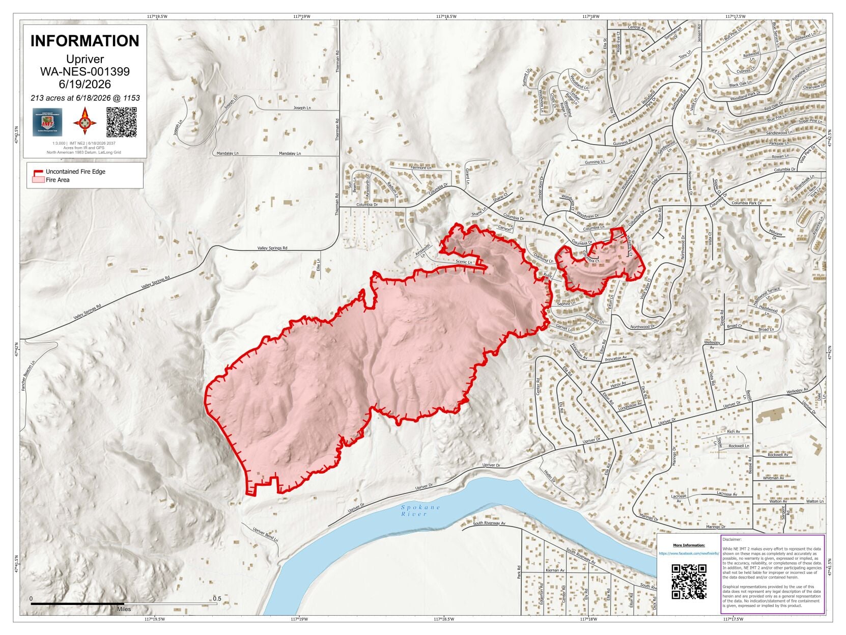
As of Friday, containment is up to 39% with an estimated acreage of 213.
Level 2 (get ready) and Level 3 (go now) are still in effect for neighborhoods closest to the fire. You can look for the most up to date maps here.
An infrared flight conducted Wednesday mapped the burned area, revealing how embers from the main fire jumped a ridge line and ignited a separate spot fire to the east during the initial wind event.
The survey identified two distinct portions of the burned area: the main body to the west and a secondary section to the east. Investigators determined that embers lofted over a ridge line and several homes, landing to the east and sparking a separate fire that burned eastward, driven by prevailing winds.
The fire’s perimeter held after the first day, a result of shifting weather conditions and suppression work by local fire crews and the water district.
Overnight, crews reported minor interior smoldering. Firefighters used hand-held infrared heat detectors to locate lingering embers near structures to the northeast, electronically mapping the hot spots to guide the incoming day shift. Utility companies confirmed all local power has been fully restored.
Thursday’s operational focus centers on protecting structures and other values at risk. Crews are identifying smoldering fuels, dousing them with water from hose lays, and turning over hot soil and embers with shovels until completely cooled — a process known as mop-up. Spokane County Fire District 9 and state mobilization resources continue supporting suppression efforts.
COPYRIGHT 2026 BY KXLY. ALL RIGHTS RESERVED. THIS MATERIAL MAY NOT BE PUBLISHED, BROADCAST, REWRITTEN OR REDISTRIBUTED.