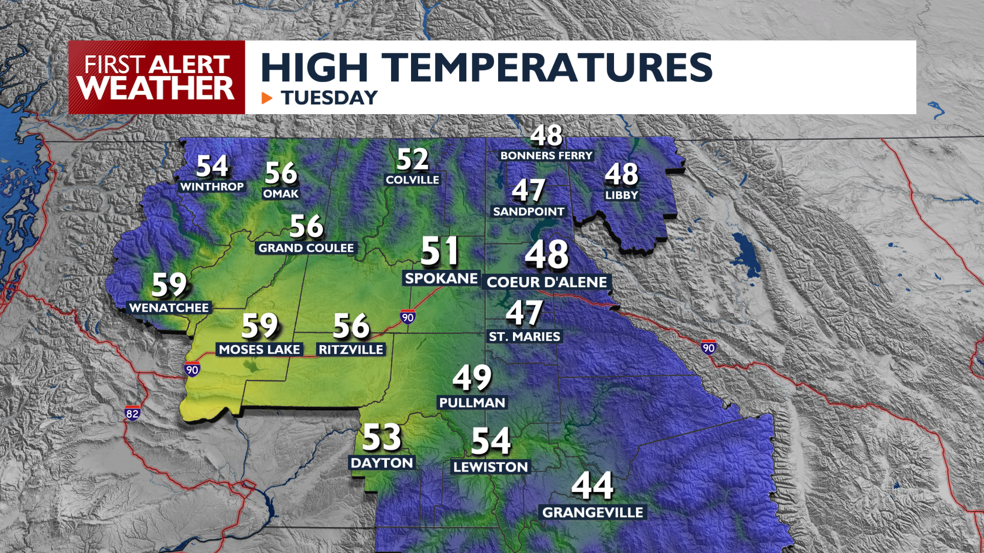
Expect more rain on Tuesday as our active weather week continues around the Inland Northwest. Our attention turns to the mountains tonight as snow returns to many of our mountain passes.
Tuesday brings scattered showers across the region with high temperatures reaching the upper 40s and low 50s. Showers are most likely early this morning and during the evening. We will be briefly between storm systems during the middle of the day, which will let us dry out somewhat. Conditions will be wetter tonight and on Wednesday morning.
Snow levels will drop low enough on Wednesday morning that we could see a rain/snow mix in places like Republic, Metaline Falls, Winthrop, and Newport. As snow levels drop further on Wednesday night, many communities north of Spokane and Coeur d’Alene will have the possibility of some rain/snow mix by early Thursday morning.
A Winter Weather Advisory begins at 5 PM Tuesday for the Cascades above 3000 feet as a weather system moves in from British Columbia. Snow levels fall to 2500 feet by Wednesday morning, creating winter travel conditions on Stevens Pass and the North Cascades Highway. Snow is also likely for Sherman Pass, Lookout Pass, and Snoqualmie Pass during this time. Showers continue in the mountains through Friday, so continue to monitor pass conditions, as more snow is likely.
Wet weather begins to ease up late Friday, with decent-looking weather for Halloween.
COPYRIGHT 2026 BY KXLY. ALL RIGHTS RESERVED. THIS MATERIAL MAY NOT BE PUBLISHED, BROADCAST, REWRITTEN OR REDISTRIBUTED.