The countdown continues towards our big cooling trend, with impacts to your plans beginning Friday.
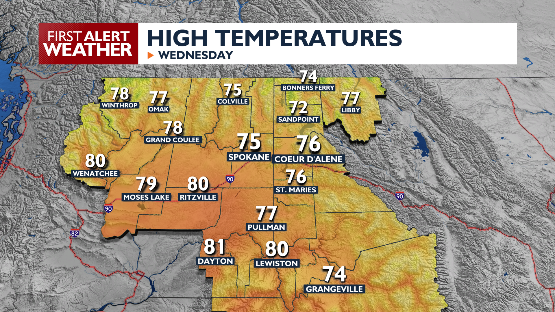
Wednesday brings high temperatures in the mid 70s, which is about 10 degrees above normal. Expect clear skies and light winds. Wednesday Night temperatures will drop into the 40s for the I-90 corridor and high 30s in sheltered mountain valleys and higher elevations.
A strong weather system arrives Friday afternoon, bringing a cold front and gusty winds between 30 and 40 mph. Blowing dust is likely around Eastern Washington.
This system will drop temperatures by more than 10 degrees starting Saturday. Mountain snow is possible Saturday Night into Sunday as snow levels fall to around 4500 feet. Lowland rain is unlikely except for communities near the northern border. Widespread frost and freeze conditions are likely early next week thanks to the weekend cooldown.
COPYRIGHT 2026 BY KXLY. ALL RIGHTS RESERVED. THIS MATERIAL MAY NOT BE PUBLISHED, BROADCAST, REWRITTEN OR REDISTRIBUTED.


