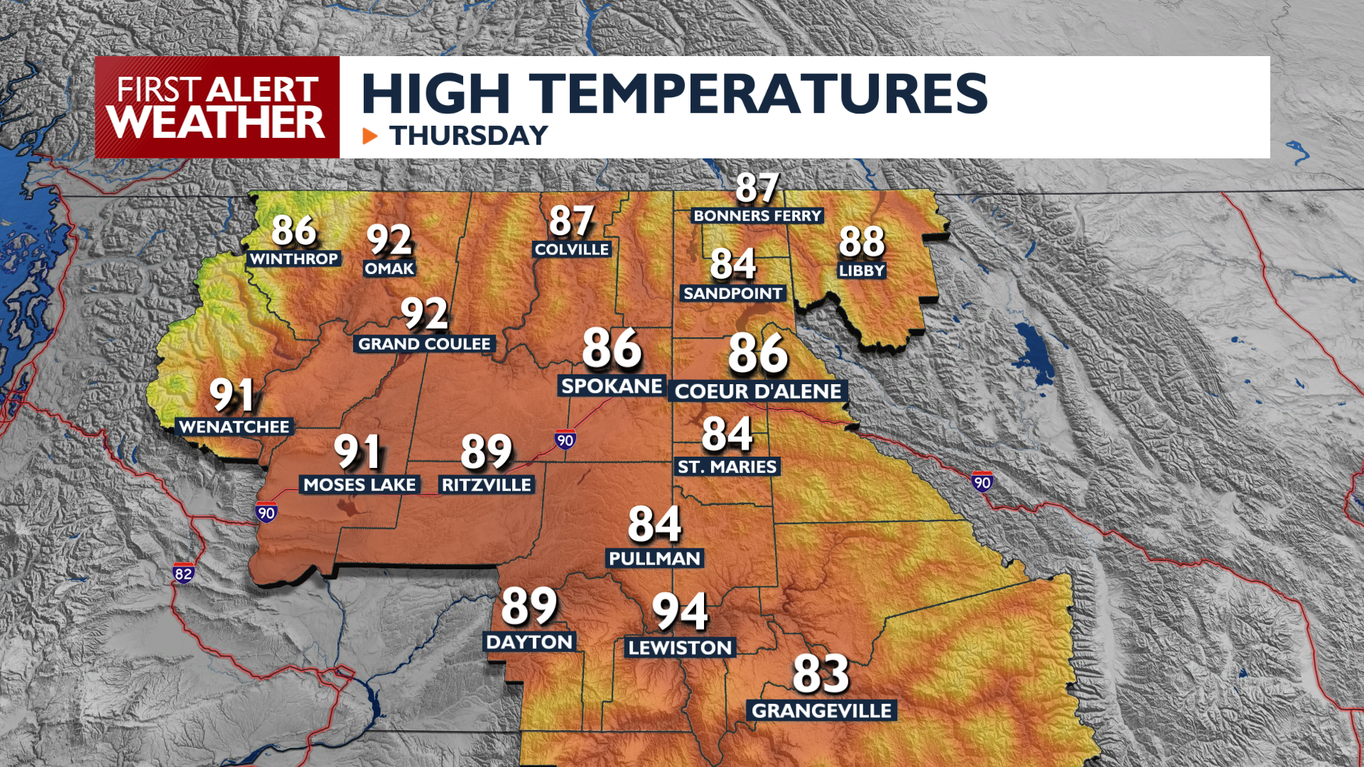
Our weather stays just breezy enough that we still need to be a little cautious when it comes to fire conditions today through the start of the weekend.
Plan Your Thursday
Thursday brings sunny, dry conditions, with high temperatures reaching the middle and upper 80s. Winds will pick up again in the afternoon, but not as high as Wednesday’s. Gusts up to 20mph will keep fire danger elevated for the afternoon. Otherwise, it looks like a great summer day.
What We’re Tracking
Saturday looks like the next day to watch. Winds will become more widespread on Saturday afternoon, particularly in the Okanogan Valley, where gusts could reach 35 to 40 mph. A couple of isolated thunderstorms will be possible on Saturday morning. Temperatures will be a little cooler this weekend with highs in the low to mid 80s.
Heat will begin to build next week in the High Plains, and we’ll be on the edge of the heat dome in the Inland Northwest. This means there are a couple of different scenarios for our weather next week. The first is for some of the hottest weather so far this summer with dry conditions, while the other puts a few more thunderstorms into the forecast with similar temperatures to this past week.
Extended Forecast
COPYRIGHT 2026 BY KXLY. ALL RIGHTS RESERVED. THIS MATERIAL MAY NOT BE PUBLISHED, BROADCAST, REWRITTEN OR REDISTRIBUTED.