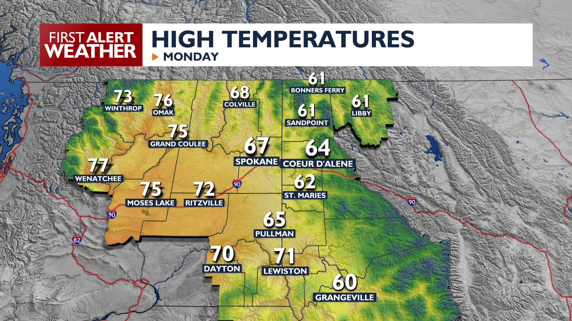
It will be a cloudy, showery Labor Day as a storm system that’s been here all weekend slowly begins to move out of the Pacific Northwest.
We’ll see plenty of scattered showers and isolated thunderstorms throughout Labor Day. Highs will reach the 60s this afternoon. Conditions will be driest around midday. Rain chances will remain elevated through early Tuesday morning before we start drying out.
A warming trend begins Tuesday as a ridge of high pressure builds, bringing temperatures close to 80 degrees Wednesday and Thursday. Another system begins to encroach late in the week, raising wind speeds on Thursday and bringing rain back into the forecast heading into next weekend.
COPYRIGHT 2026 BY KXLY. ALL RIGHTS RESERVED. THIS MATERIAL MAY NOT BE PUBLISHED, BROADCAST, REWRITTEN OR REDISTRIBUTED.