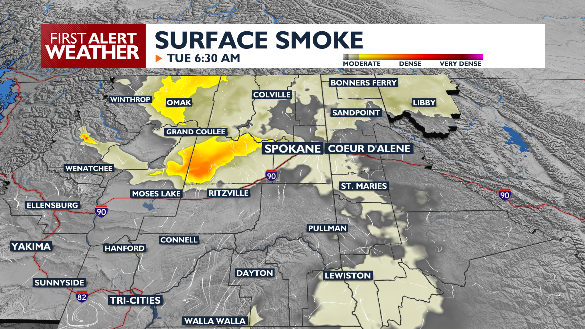
A warming trend that got started on Sunday continues today, with temperatures reaching the 80s and low 90s under building high pressure. While the region remains mostly dry, mountain areas along the Canadian border and Blue Mountains face a 10 to 15 percent chance of weak thunderstorms during the afternoon and evening. Wildfires will be more active in the heat, which could lead to additional smoke and haze this evening.
The air will likely be a little smokier on Tuesday, followed by localized breeziness. Winds will blow in some light to moderate smoke from fires in the Cascades.
Conditions remain dry and warm through mid-week before a significant pattern change arrives Saturday. A cold front will bring cooler temperatures in the 80s, along with sustained winds between 10 and 20 mph, with gusts in the 25+ mph range. These gusty conditions will lead to elevated fire concerns across the region at the start of the weekend. Ahead of the front on Friday thunderstorms will be possible in the region, but rain chances remain on the low side for now.
COPYRIGHT 2026 BY KXLY. ALL RIGHTS RESERVED. THIS MATERIAL MAY NOT BE PUBLISHED, BROADCAST, REWRITTEN OR REDISTRIBUTED.