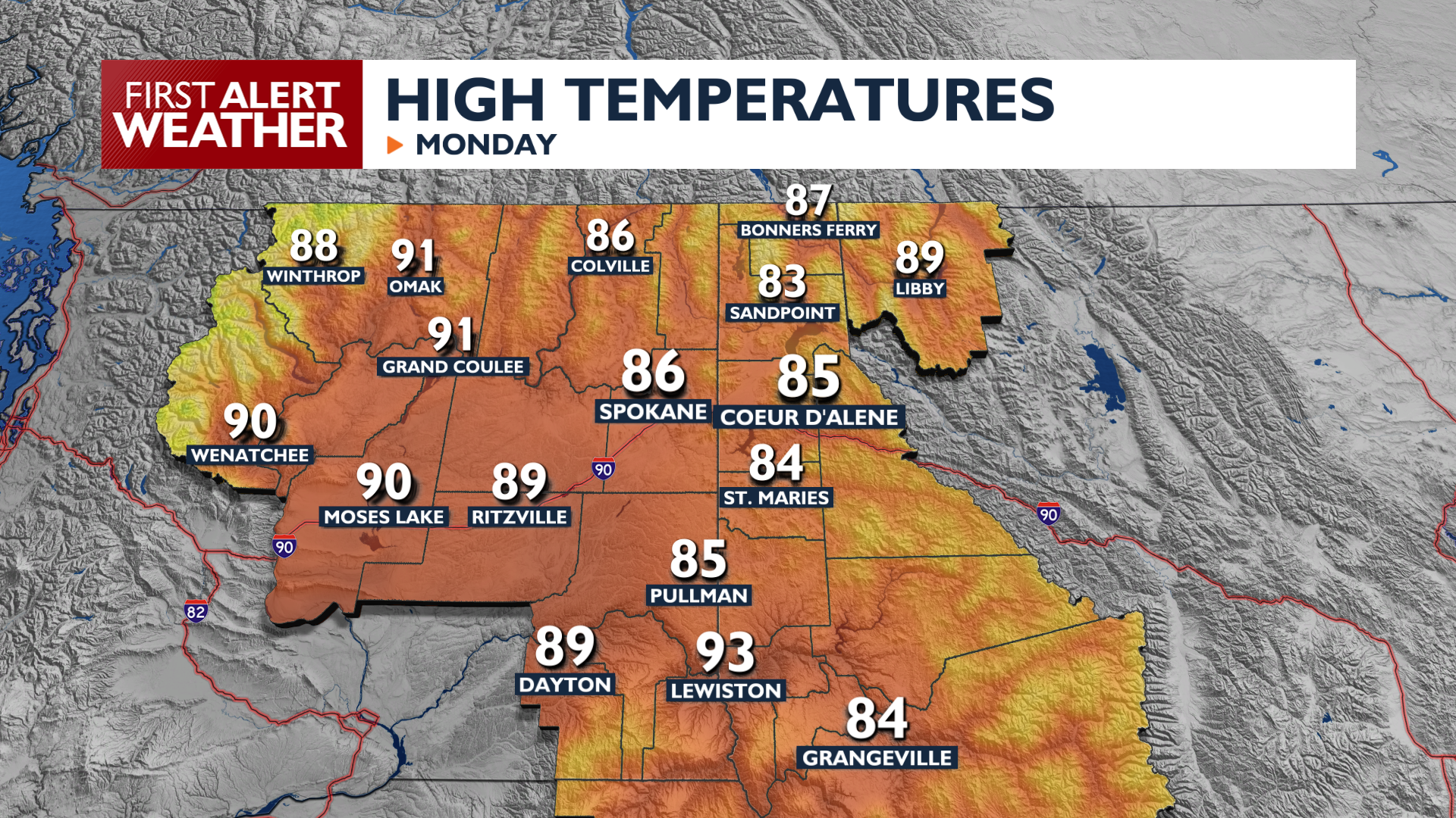
The week starts smoky, but a change in our weather could bring some relief later this week.
Monday brings widespread smoke and haze with air quality remaining at or near unhealthy levels. Expect breezy conditions this afternoon with wind gusts between 15 and 20 mph across the Columbia Basin and the West Plains. The breeze may get smoke moving a little, but it’s unlikely there will be a significant improvement in air quality for more than an hour or two. High temperatures will be average for mid-August, in the mid 80s to low 90s.
On Wednesday, a weather system brings a chance of showers and thunderstorms, primarily in the mountains north of I-90. These storms could produce erratic wind gusts up to 30 mph and lightning. This unsettled pattern continues into Thursday with a focus on Northeastern Washington and North Idaho. Rain in the right spot at the right time could help out or smoke situation significantly, but lightning strikes have an incredibly high chance to start new fires.
Temperatures will remain at or just below average later in the week, with highs in the 80s and lows in the 50s.
COPYRIGHT 2026 BY KXLY. ALL RIGHTS RESERVED. THIS MATERIAL MAY NOT BE PUBLISHED, BROADCAST, REWRITTEN OR REDISTRIBUTED.