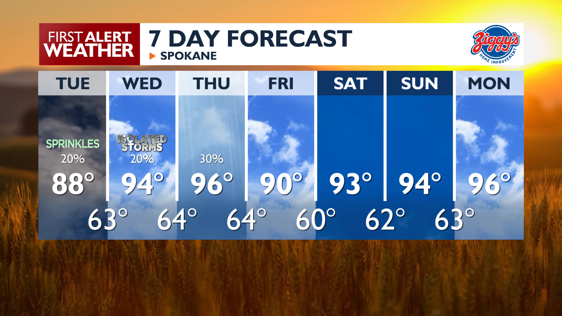
We’ll start the day with another round of clouds as our weather pattern turns more active heading into the middle of the week.
Plan Your Tuesday
Cloudy skies along the Washington-Idaho state line will keep temperatures cooler today in much of the Inland Northwest. Highs will only reach the 80s in these areas, with a few spots only hitting the 70s in the Central Panhandle. In the Columbia Basin, it will be sunnier, so highs will reach the middle and upper 90s. Temperatures will rise quickly once the sunshine returns in the late afternoon.
Some much-welcomed rain is possible with the clouds during the morning, with a 50% chance in the Central Panhandle and 20% to 30% chance around Spokane and Coeur d’Alene.
What We’re Tracking
The heat intensifies Wednesday and Thursday as highs climb into the middle 90s with some lower 100s in the Columbia Basin. A surge of moisture will increase the risk of thunderstorms on Wednesday afternoon, particularly over the mountains. These storms may be on the drier side, which increases the potential for new fire starts due to lightning and gusty outflow winds. Thunderstorms are likely to be more widespread on Thursday. Storm conditions calm on Friday, but the heat will build again through the weekend with highs in the middle and upper 90s.
Extended Forecast
COPYRIGHT 2026 BY KXLY. ALL RIGHTS RESERVED. THIS MATERIAL MAY NOT BE PUBLISHED, BROADCAST, REWRITTEN OR REDISTRIBUTED.