It’s the hottest day this week before a significant pattern change mixes up our conditions over the following 48 hours.
Plan Your Wednesday
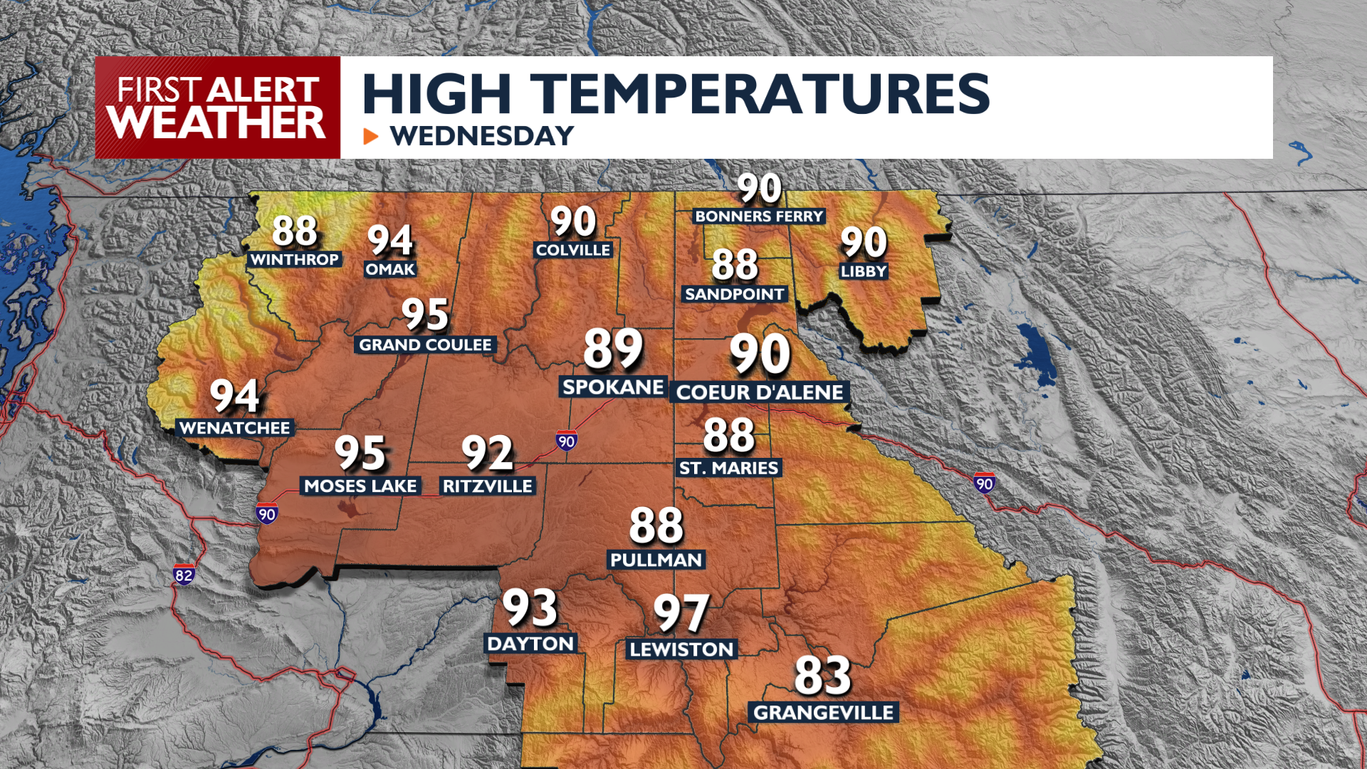
This afternoon brings the warmest temperatures of the week with highs between 88 and 96 degrees. Thunderstorms are possible during Wednesday afternoon and evening, mainly in Northeast and North-Central Washington with only isolated coverage elsewhere.
What We’re Tracking
A Fire Weather Watch is in effect for Thursday afternoon in Eastern Washington, thanks to gusty winds expected in the afternoon. These winds won’t be as strong as last Tuesday’s were, but vegetation in the region has had another week to dry out. We’ll continue to monitor conditions for the possibility of a Weather Alert Day.
Conditions will change significantly on Friday as a cold front arrives, dropping high temperatures into the 60s and 70s with a high chance of rain. Showers remain possible at times this weekend while temperatures will be well below normal.
Extended Forecast
COPYRIGHT 2026 BY KXLY. ALL RIGHTS RESERVED. THIS MATERIAL MAY NOT BE PUBLISHED, BROADCAST, REWRITTEN OR REDISTRIBUTED.

