A strong cold front brings gusty winds and elevated fire concerns on Tuesday, followed by a dry and warming trend through midweek.
Plan Your Tuesday
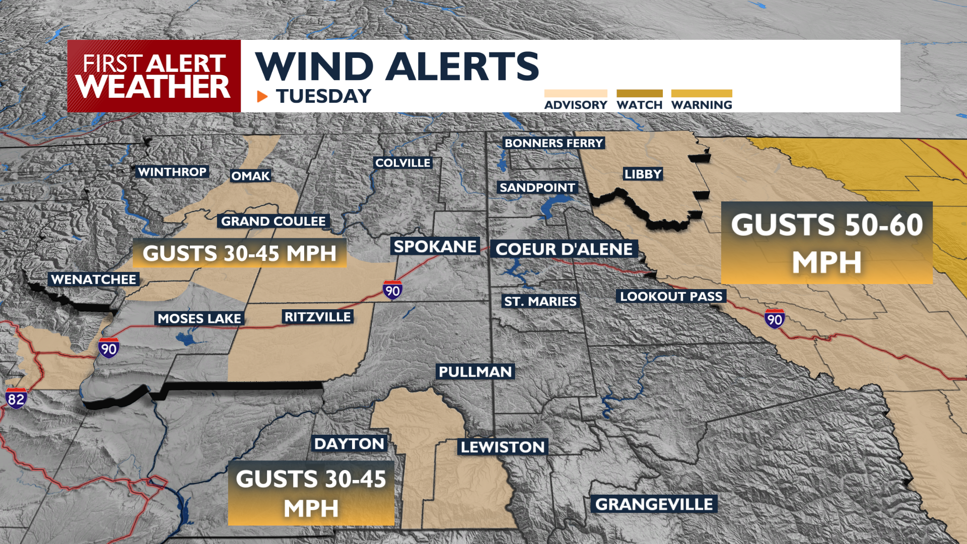
Wind Advisories are in effect around the region from 8 a.m. to 5 p.m. Tuesday. Winds will gust up to 45 mph in the Blue Mountains, Upper Columbia Basin, Okanogan Valley, and Northwest Montana. Gusts up to 35 mph will occur around Spokane and Coeur d’Alene. High temperatures will stay in the mid-50s to mid-60s with very dry air, increasing the risk for grass fires. Some blowing dust is also a possibility in Central Washington.
What We’re Tracking
High pressure builds Wednesday through Friday, bringing dry conditions and a warming trend with highs getting close to the 70s again Friday afternoon. The next major change arrives Saturday and Sunday as a low-pressure system brings a chance of rain. Your plans this weekend will face a lot more difficulty from the weather than last weekend.
Extended Forecast
COPYRIGHT 2026 BY KXLY. ALL RIGHTS RESERVED. THIS MATERIAL MAY NOT BE PUBLISHED, BROADCAST, REWRITTEN OR REDISTRIBUTED.