It won’t be as snowy as this morning, but some scattered snow is likely this afternoon, followed by a big drop in temperatures tonight.
Plan Your Wednesday
Look for scattered snow showers with some sunshine in between this afternoon. These showers will have much less of an impact than this morning, with only a little skiff of accumulation during any given shower. High temperatures will creep up just above freezing in the I-90 corridor, which should help out with road conditions for the evening.
Cold air is sitting on our doorstep, and some less-cloudy skies tonight should help us drop down to the teens and low 20s for tomorrow morning.
What We’re Tracking
Scattered snow showers continue tonight and tomorrow. Snow is most likely along the eastern foot of the Cascades from Vantage up to Wenatchee, Chelan, Omak, and Oroville. Scattered snow will continue into Thursday afternoon across Northeast Washington and the northern Idaho Panhandle. Temperatures will be much colder than recent weeks, with lows in the teens and low 20s and highs around freezing.
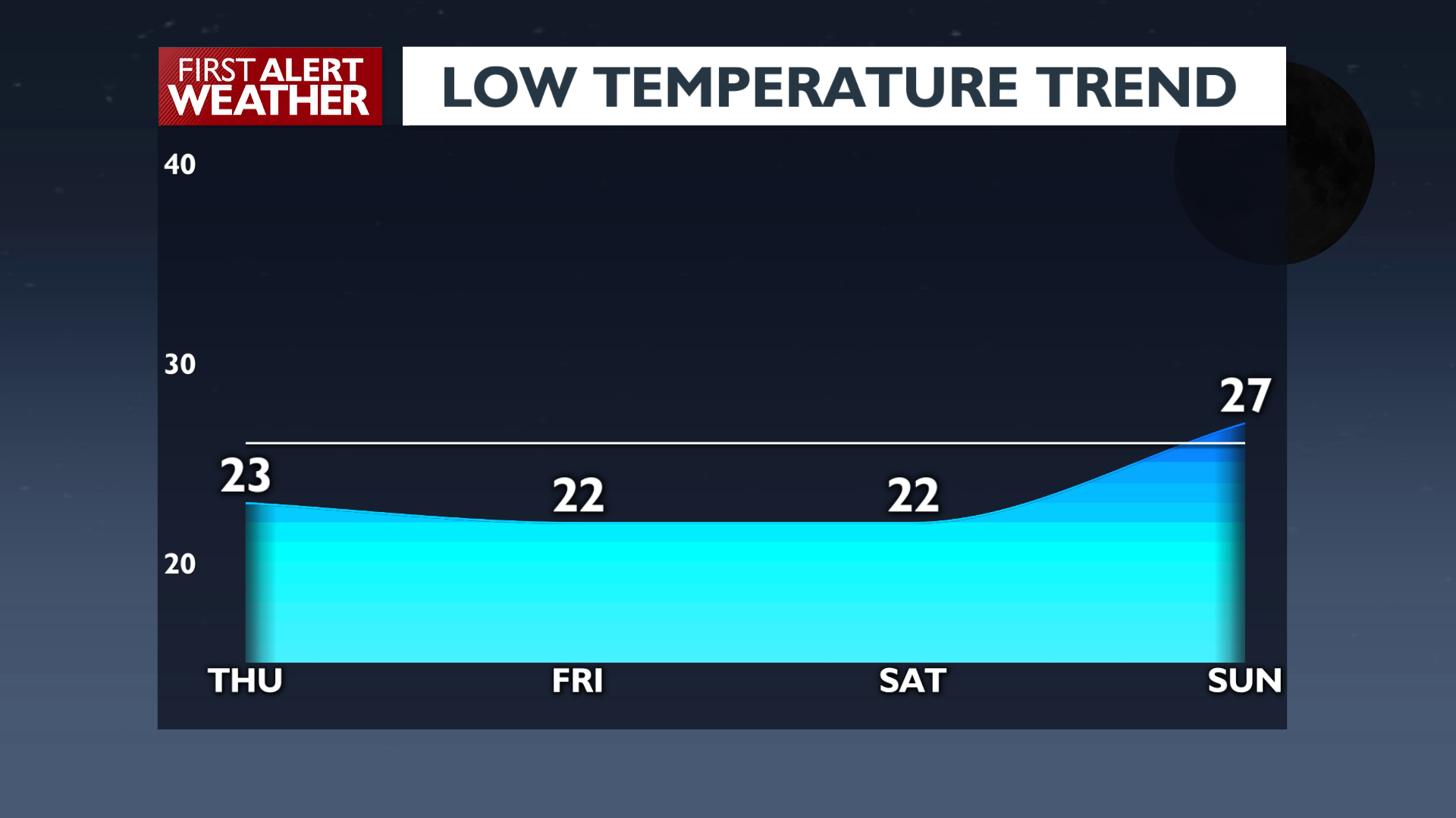
Friday will be similarly cold, but without as much snow shower activity. Conditions warm up significantly over the weekend ahead of rain and mountain snow heading into next week.
Extended Forecast
COPYRIGHT 2025 BY KXLY. ALL RIGHTS RESERVED. THIS MATERIAL MAY NOT BE PUBLISHED, BROADCAST, REWRITTEN OR REDISTRIBUTED.
