A dry and stagnant weather pattern is locked in place today, bringing low clouds and fog to many of our valleys.
Plan Your Wednesday
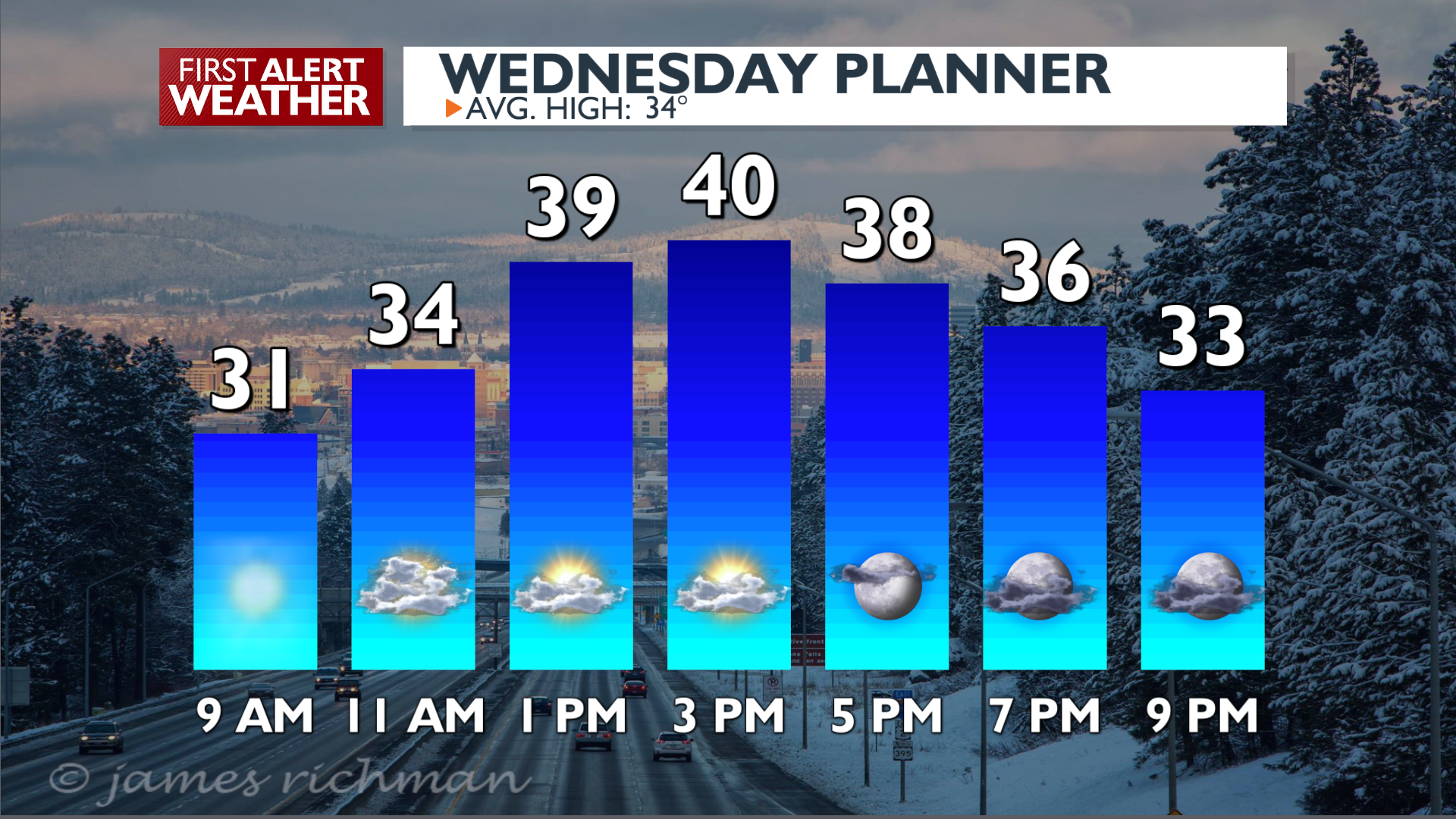
Low clouds and fog are expanding into most of our northern valleys this morning. Due to a strong overnight inversion and lack of mixing air near the ground, air quality is likely to degrade in these areas. An Air Stagnation Advisory is in place across Northeast Washington and much of North Idaho. Expect cooler temperatures in the valleys, likely in the 30s, while higher elevations benefit from warmer conditions in the 40s to low 50s.
Places like the Palouse and Central Washington are expected to reach the 40s today. We’ll see a decent amount of sunshine in these areas, with the day split between fog and sun around Spokane and Coeur d’Alene.
What We’re Tracking
The persistent dry and stable pattern driven by a strong ridge of high pressure will continue into the weekend. It will become foggier and cloudier around Spokane and Coeur d’Alene day by day and for longer each day. Changes come this weekend as the ridge shifts slightly, leading to colder air moving in for Sunday and Monday. This will also help break up some of the inversions enough for us to see a little bit of sunshine up north. Any chance for precipitation holds off until the middle of next week at the earliest.
Extended Forecast
COPYRIGHT 2025 BY KXLY. ALL RIGHTS RESERVED. THIS MATERIAL MAY NOT BE PUBLISHED, BROADCAST, REWRITTEN OR REDISTRIBUTED.