Low-lying areas in the Cascades and parts of the Idaho Panhandle face continued flooding risks today from rain and snowmelt. Meanwhile, the windy weather we’ve dealt with the last 24 hours will diminish significantly today.
Plan your Thursday
The persistent atmospheric river (AR) system responsible for recent high winds, heavy rain, and snowmelt is shifting south across the region. Rain this afternoon will focus on Southeast Washington.
Flood Warnings are in effect between Cataldo and Harrison on the Coeur d’Alene River. The flood warning that was in place for Calder on the St. Joe River has been cancelled, but the river between Avery and Saint Maries will be running full through the start of the weekend. Small creeks and streams in the region will continue to experience periodic flooding from rain and snowmelt.
Flooding in Western Washington will significantly impact travel. Most roads through the mountains are closed. If you can avoid traveling west, it would be wise to do so.
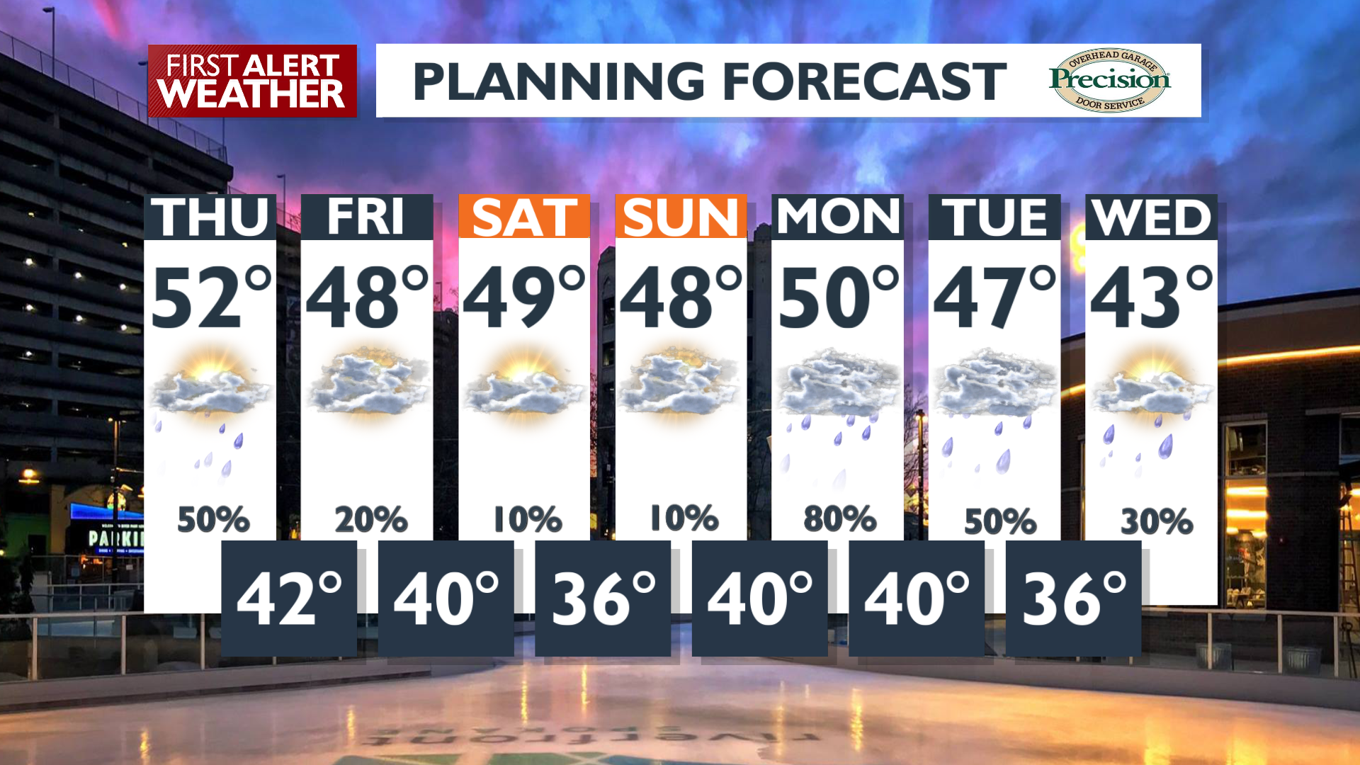
Temperatures will spend most of the day in the 50s. The strong winds from early this morning will just be a light breeze for the end of the day.
What We’re Tracking
A few more showers are possible late tonight before this storm finally exits the region. Over the weekend, there will be a brief calm period on Friday and Saturday before a weak system brings light rain to the mountains on Sunday.
Another pulse of rain and high mountain snow is likely on Monday as another atmospheric river arrives. This could cause additional rises in rivers and streams across the Cascades and Idaho Panhandle. Expect rain in the valleys at times through the middle of next week.
Extended Forecast
COPYRIGHT 2025 BY KXLY. ALL RIGHTS RESERVED. THIS MATERIAL MAY NOT BE PUBLISHED, BROADCAST, REWRITTEN OR REDISTRIBUTED.