Heavy mountain rain and soaking valley showers will wash out your Monday while we wait for strong gusty winds to impact our region tonight.
Plan Your Monday
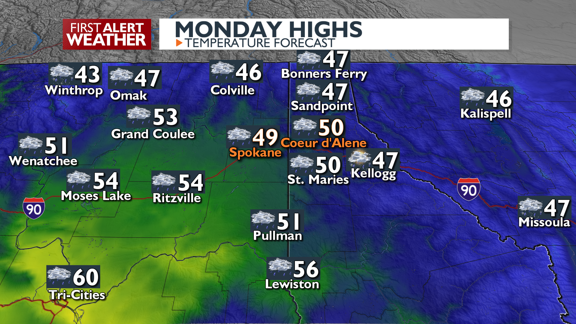
It will be warm today despite the clouds and rain. Low and mid-elevation areas will experience rain, with any snow confined to the high mountains. Areas like Spokane, Pullman, and Sandpoint have an 80 to 100 percent chance of seeing at least a quarter inch of rain. Streamflows will begin to rise, and there is an increased chance for mud and rockslides in steep terrain and near burn scars in the North Cascades and Central Idaho Panhandle. In addition to all of this, avalanche danger is high in the backcountry as rain fall on top of snow in all but the highest elevations.
Wind gusts 40 to 55 mph are likely across the Columbia Basin and Palouse this evening. A Wind Advisory is in effect tonight for most of the region. Strong winds could snap off a few tree limbs and we can’t rule out a few power outages happening.
What We’re Tracking
The active, wet weather pattern continues into the middle of the week as another system arrives Tuesday evening through Thursday. Rainfall totals could reach an inch or more in mountain regions by Thursday morning. River impacts are expected, with the Coeur d’Alene River forecast to reach Minor Flood Stage. Temperatures will remain well above normal throughout this period.
Extended Forecast
COPYRIGHT 2025 BY KXLY. ALL RIGHTS RESERVED. THIS MATERIAL MAY NOT BE PUBLISHED, BROADCAST, REWRITTEN OR REDISTRIBUTED.

