We’ll have a few areas of light rain this morning in our southern counties. Otherwise, it’s a cooler start to Thursday for many of us with pleasant afternoon weather on the way again.
Plan your Thursday
Light rain is likely this morning across southeastern Washington and the southern Idaho Panhandle. Elsewhere, expect just a few more clouds to start the day. We’ll see partly to mostly cloudy skies through the evening. Temperatures will remain warmer than average for this time of year in the 40s for highs.
What We’re Tracking
Heading into Friday and Saturday, higher pressure builds, continuing our mostly dry conditions. However, wet weather will hover over British Columbia and might bring a sprinkle to the North Cascades and northern valleys through Saturday. Active weather returns Sunday into Monday night with a cold front bringing rainy conditions to the valleys and snow to the mountains and passes.
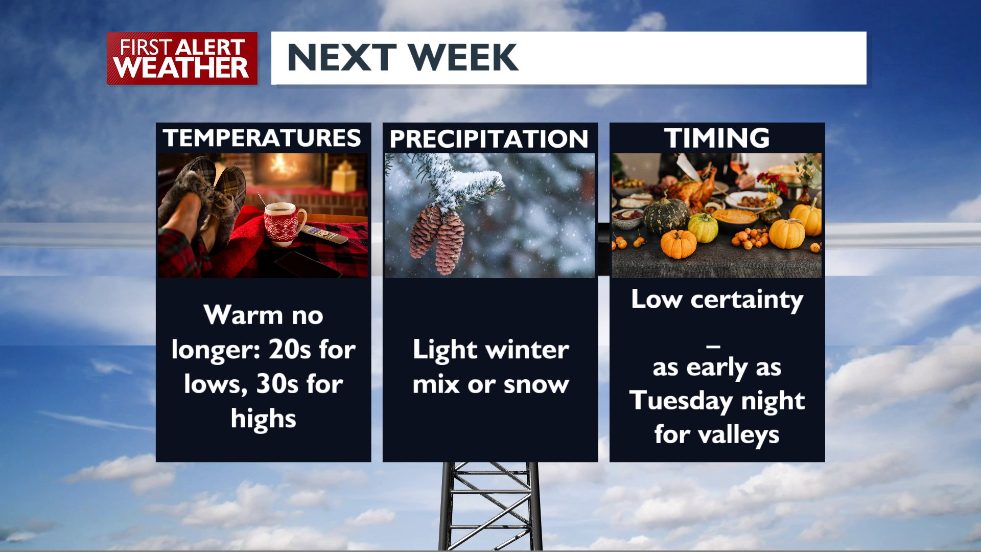
Gusty winds will bring in colder air behind this front. It will be significantly colder next week, and we expect at least one weather system to arrive between next Tuesday and Saturday, bringing with it a chance for valley winter mix and/or snow. We are still working out the timing, so stick with us as we update the forecast for the next few days.
Extended Forecast
COPYRIGHT 2025 BY KXLY. ALL RIGHTS RESERVED. THIS MATERIAL MAY NOT BE PUBLISHED, BROADCAST, REWRITTEN OR REDISTRIBUTED.