A few more clouds, some mountain thunder, and a shift in winds are all signs that we are getting closer to the end of this heat wave than the beginning. Still, it will be staying hot for a couple more days until temperatures begin to respond to this shift in our pattern.
What We’re Tracking
Extreme Heat Warning in the Columbia Basin and LC Valley for triple-digit heat and lows only in the 70sHeat Advisory for 95-99 degree afternoons in Spokane and Coeur d’AleneFire Weather Warning for dry lightning and gusty winds in the North Cascades for Monday and TuesdaySky conditions will be cloudier than it was this past weekendHighs will be within 5 degrees of record highs the next two daysAir quality will be less of a problem around the Palouse and LC Valley as winds push smoke back up into the mountainsThe heat breaks Thursday with breezy, cloudy weather and an isolated shower and/or thunderstorm Temperatures will settle in the mid to upper 80s for Labor Day weekend
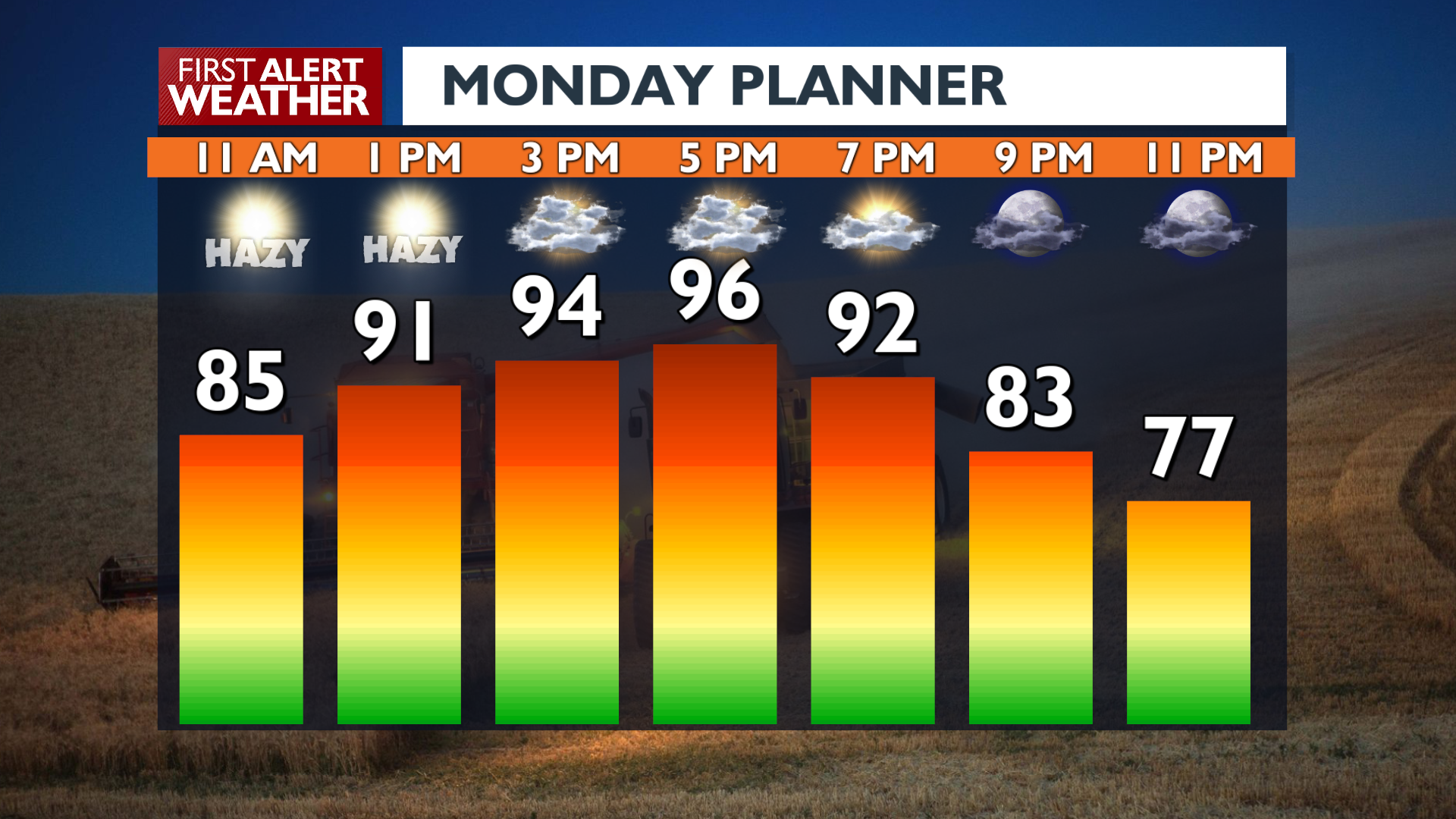
Plan your Monday
Extended Forecast
COPYRIGHT 2025 BY KXLY. ALL RIGHTS RESERVED. THIS MATERIAL MAY NOT BE PUBLISHED, BROADCAST, REWRITTEN OR REDISTRIBUTED.