SPOKANE, Wash.– Since late November, North America has more or less been in a weather pattern of storminess in the East and drier, warmer conditions in the West.
In the Inland Northwest, weaker storms have come and gone, but that larger pattern has always returned quickly. More of the same is expected in late December, with mild weather in the West that eventually spreads across the country by the end of the year.
When will this change?
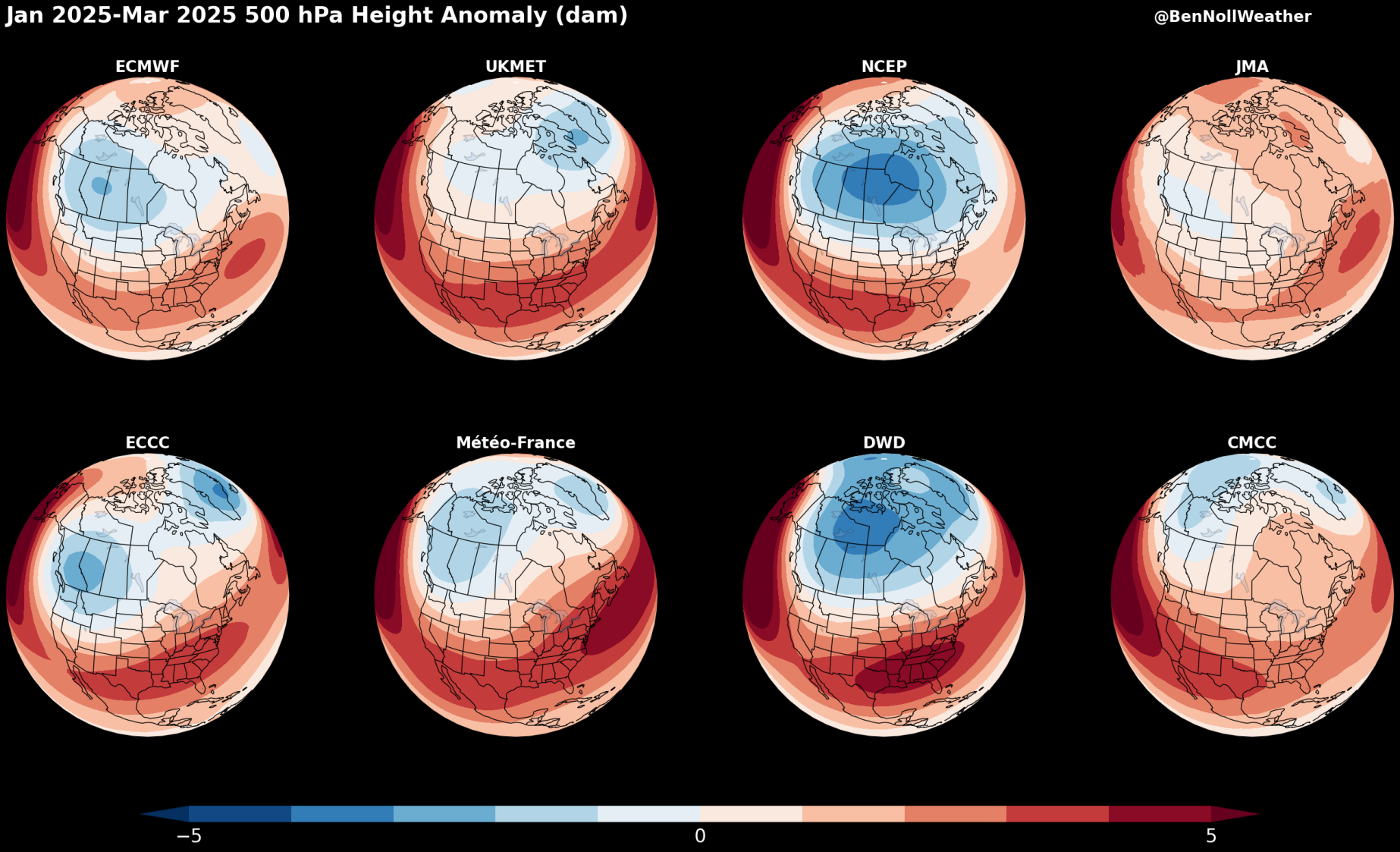
Here are what some of the long-range forecasting computers are showing. This data comes from the European Union and is compiled into graphics by meteorologist Ben Noll.
These are eight different weather models looking at the large-scale weather pattern for January through March 2025.
Where you see red, you’re more likely to have dry and mild weather. Where it’s blue, you’re more likely to see wet and cold weather. Notice that the majority of these models place this activity over Western Canada and the Northwest United States.
This pattern in the majority of models would make sense when and if La Niña finally shows up. La Niña encourages wet and cool weather in the Northwest by influencing certain weather features near our region in a particular way. Meteorologists call it the Pacific-North American Pattern.
Computer models from NOAA here in the United States also show a strong possibility of cooler and wetter conditions to start the year in the Northwest and Western Canada.
So, what do we take away from this? A lot of data is pointing toward the second half of winter being more “winter-y” in the Inland Northwest than what we’ve experienced so far. Don’t be surprised if winter weather activity starts ramping up next month.
COPYRIGHT 2024 BY KXLY. ALL RIGHTS RESERVED. THIS MATERIAL MAY NOT BE PUBLISHED, BROADCAST, REWRITTEN OR REDISTRIBUTED.