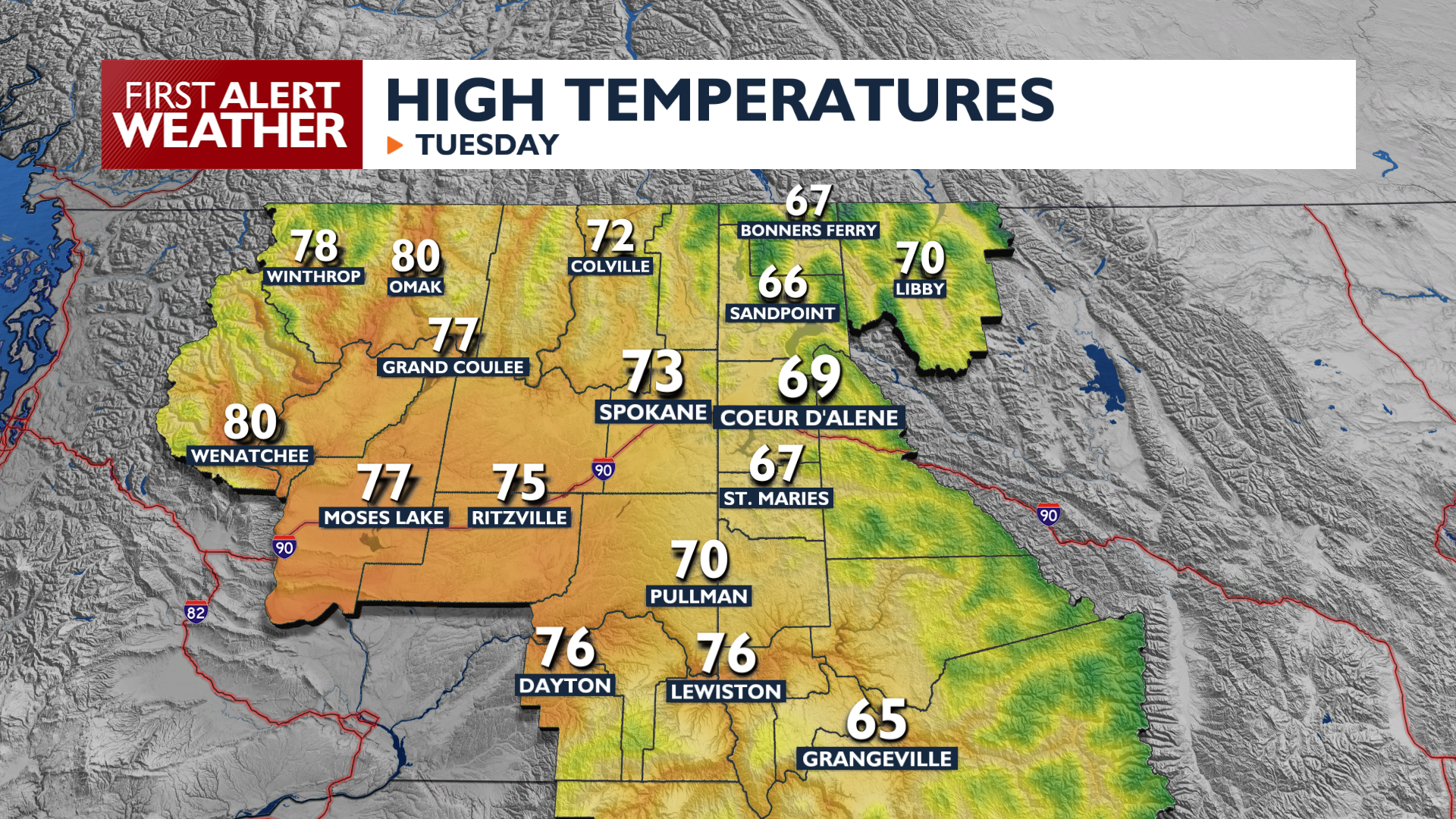
Tuesday will be a transitional day as sunnier, warmer conditions arrive this afternoon.
Cloudy skies and damp roads will dry up and move out as we head into Tuesday afternoon. High temperatures will climb into the 70s this afternoon before dropping into the 40s and low 50s Tuesday Night. Parts of North Idaho will stay cloudier for more of the day and will only hit the middle to upper 60s.
Looking ahead, temperatures will rise close to 80 degrees on Wednesday and Thursday. As the next storm system approaches on Thursday, we will see some gusty afternoon winds. Expect westerly gusts up to 30 mph across the Basin, with local gusts reaching 40 mph and potential blowing dust in some areas of Central Washington. Rain chances will rise this weekend as temperatures drop again.
COPYRIGHT 2026 BY KXLY. ALL RIGHTS RESERVED. THIS MATERIAL MAY NOT BE PUBLISHED, BROADCAST, REWRITTEN OR REDISTRIBUTED.