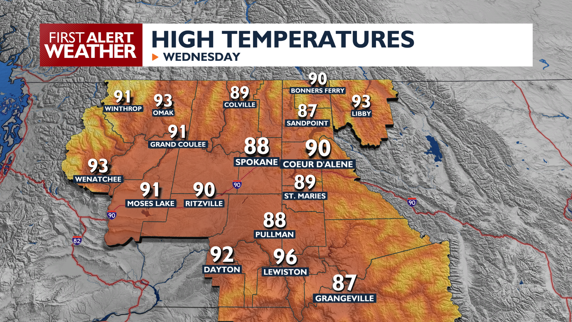
Wednesday is looking like a nice warm summer day, but building heat will start to make us all sweat by the time we hit the weekend.
Hazy conditions continue in Northeast Washington, where an Air Quality Alert is in place until the end of the week. Elsewhere, it will be warm with light haze for the afternoon under mostly sunny skies. Temperatures will hit the upper 80s and low 90s for highs.
High pressure strengthens to end the week, which will push temperatures into the middle to upper 90s by Friday afternoon. An incoming system will drop temperatures for the weekend, but it will come with complications.
Thunderstorms are likely in the region Friday night and Saturday, but heavy rain doesn’t appear to be in the cards for most areas. Lightning will strike ahead of gusty winds on Saturday afternoon as the system passes. With gusts around 30 mph, fire danger will be elevated for the second half of Saturday. Once the system passes, cooler temperatures and (hopefully) clear skies will make for a nice Sunday.
COPYRIGHT 2026 BY KXLY. ALL RIGHTS RESERVED. THIS MATERIAL MAY NOT BE PUBLISHED, BROADCAST, REWRITTEN OR REDISTRIBUTED.


