Thunderstorms fade this morning while breezy conditions and less smoky air stick around for most of Thursday.
Scattered thunderstorms continue through the early to mid-morning in Northeast Washington and North Idaho. New fires remain possible for the next 2-4 days from these lightning strikes.
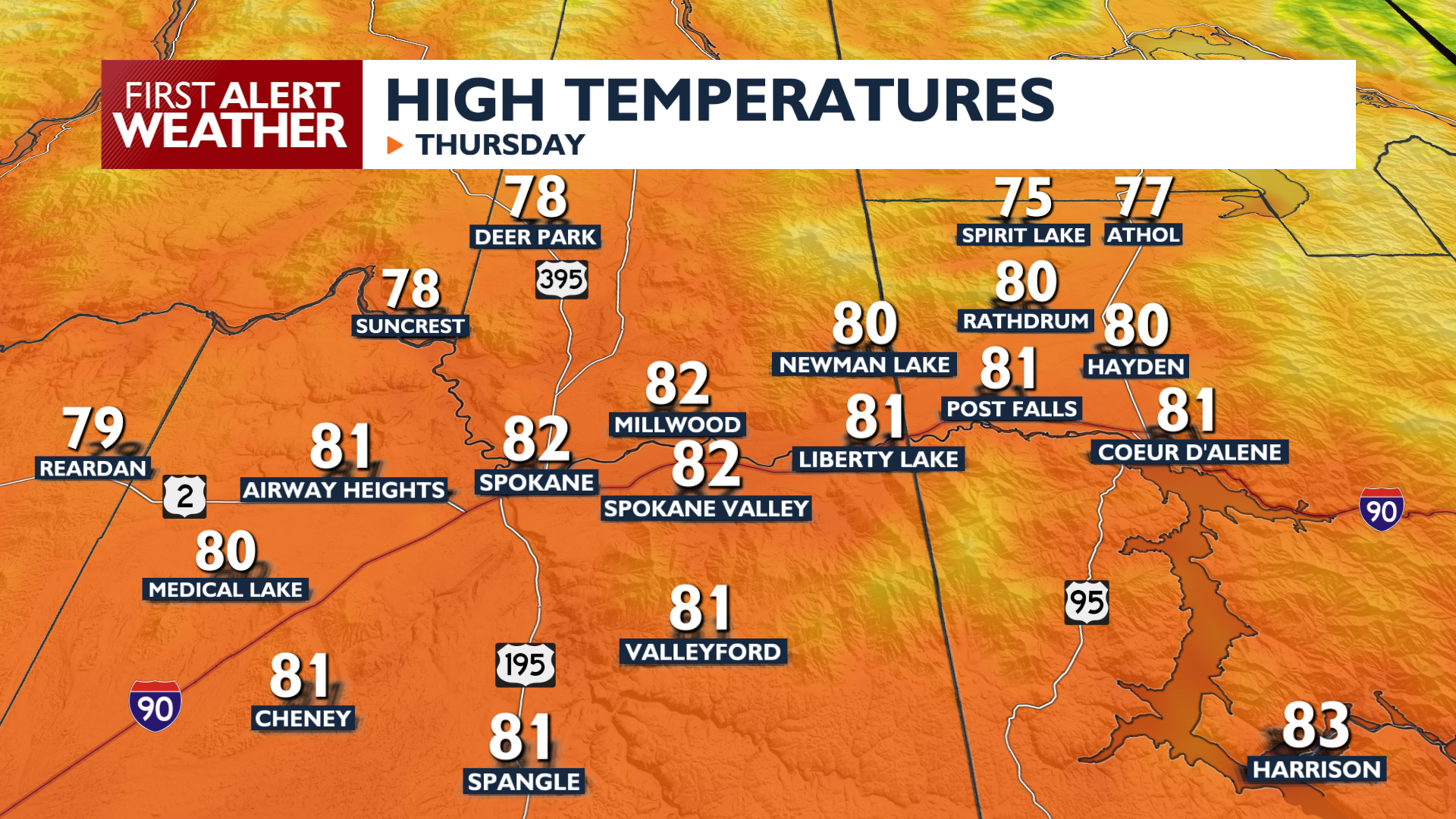
High temperatures on Thursday will range from the 70s to the lower 80s. Breezy winds out of the northeast will continue today, especially in Bonner and Boundary counties. Those winds will help sweep much of the smoke out of our northern valleys. Hazy conditions will persist in our southern regions, including the Palouse and Blue Mountains.
Looking ahead to Friday and the weekend, a strengthening ridge will push the current weather system out, leading to warmer and drier conditions. High temperatures will climb into the upper 80s for the start of next week, with only isolated afternoon showers expected over higher terrain. While showers are possible, they are too light and too few in number to provide relief for ongoing fire concerns.
COPYRIGHT 2026 BY KXLY. ALL RIGHTS RESERVED. THIS MATERIAL MAY NOT BE PUBLISHED, BROADCAST, REWRITTEN OR REDISTRIBUTED.