It’s another day where some nice morning weather will become unsettled during the afternoon
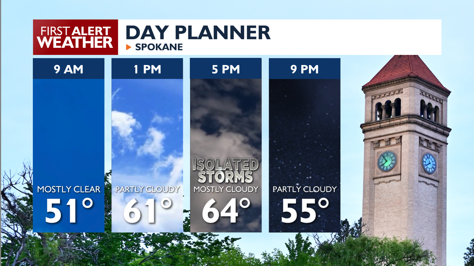
Plan Your Monday
As the day progresses, daytime heating will trigger isolated showers and thunderstorms, primarily over the higher terrain of northeast Washington and the Northern Panhandle. These storms could produce wind gusts up to 25 mph and small hail. Afternoon highs will hit the 60s for the first time in a couple of days.
What We’re Tracking
The overall pattern doesn’t change that much through Wednesday, and we’ll be slightly warmer with slightly less shower and storm coverage each afternoon.
The warming trend kicks up a notch as high pressure takes over for the end of the workweek. We’ll see highs in the low to mid-70s by the start of the holiday weekend.
The weekend forecast features a lot of uncertainty, with a couple of different scenarios that are equally possible at the moment. Stay with 4 News Now this week for First Alert updates when weekend conditions come into focus.
Extended Forecast
COPYRIGHT 2026 BY KXLY. ALL RIGHTS RESERVED. THIS MATERIAL MAY NOT BE PUBLISHED, BROADCAST, REWRITTEN OR REDISTRIBUTED.