Hello there! The warming trend comes to an end after today, with spring arriving and cooler temperatures moving in this weekend.
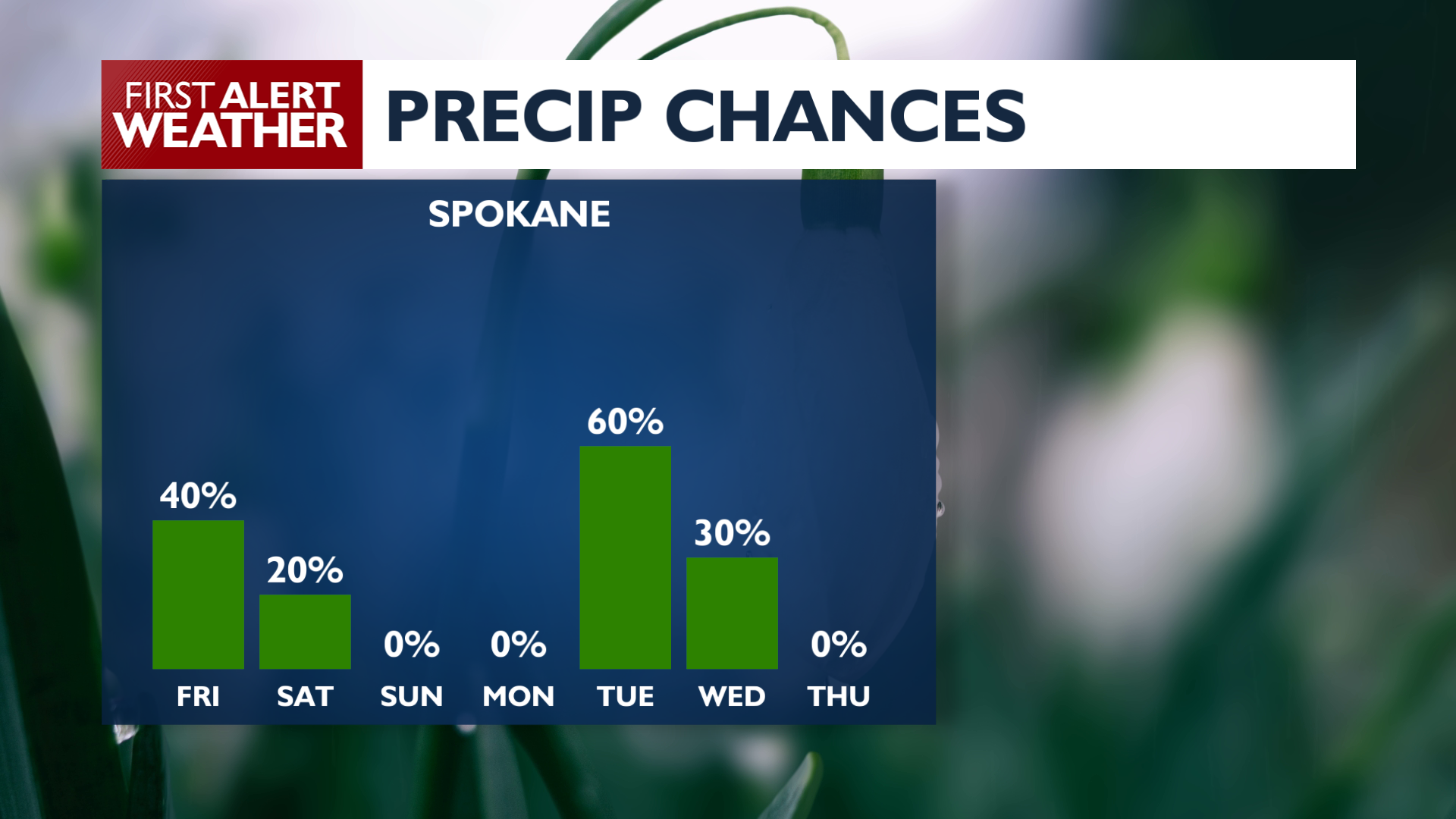
For Friday, warm conditions continue across the region with highs in the mid-60s. Winds stay breezy at 15–20 mph, with gusts possibly reaching the upper 20s. There’s also a 40% chance of showers late afternoon into early evening.
Showers taper off after early Saturday morning, with mainly dry weather expected for most of the weekend and into Monday. Showers return Tuesday, and some could be heavy at times. Snow may also return to the passes Tuesday.
Over the next 7 days, temperatures trend cooler and return to seasonal levels. Expect mid to lower 50s starting Saturday and continuing into next week. Plenty of sunshine this weekend, with increasing clouds and shower chances during the work week.
Enjoy spring!
—Jason
COPYRIGHT 2026 BY KXLY. ALL RIGHTS RESERVED. THIS MATERIAL MAY NOT BE PUBLISHED, BROADCAST, REWRITTEN OR REDISTRIBUTED.