Expect a bit of soaking weather at times today as valley rain and mountain snow stick around through today and tonight.
Plan Your Monday
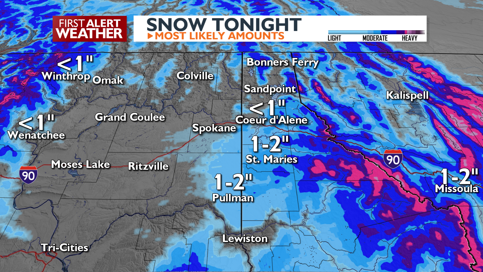
Wet weather is already becoming less of an issue in our northern counties, and the rain will continue to focus on areas south of I-90 in the late afternoon. Wet weather will only occasionally work its way back north to Spokane and Coeur d’Alene in the evening and overnight. As temperatures cool this evening, snow is likely around the central panhandle mountains and the Palouse region. A little rain/snow mix is even possible tonight in the I-90 corridor.
Mountain passes will continue to get dumped on during this period. 5-9″ of snow is likely for Lookout and Stevens Passes by Tuesday morning. Snoqualmie Pass will also see snow in the 4-6″ range.
What We’re Tracking
Rain/snow mix continues at times on Tuesday before we dry out for the next several days. Light morning snow around the Palouse and central Idaho Panhandle will slow down the commute.
A system passing to our north late in the week will ramp up the winds, especially on Thursday. At this point, we may be looking at some gusts over 40 mph. We’ll continue to update the potential for strong winds throughout the week. Temperatures will stay average to slightly warmer than normal for late February
Extended Forecast
COPYRIGHT 2026 BY KXLY. ALL RIGHTS RESERVED. THIS MATERIAL MAY NOT BE PUBLISHED, BROADCAST, REWRITTEN OR REDISTRIBUTED.
