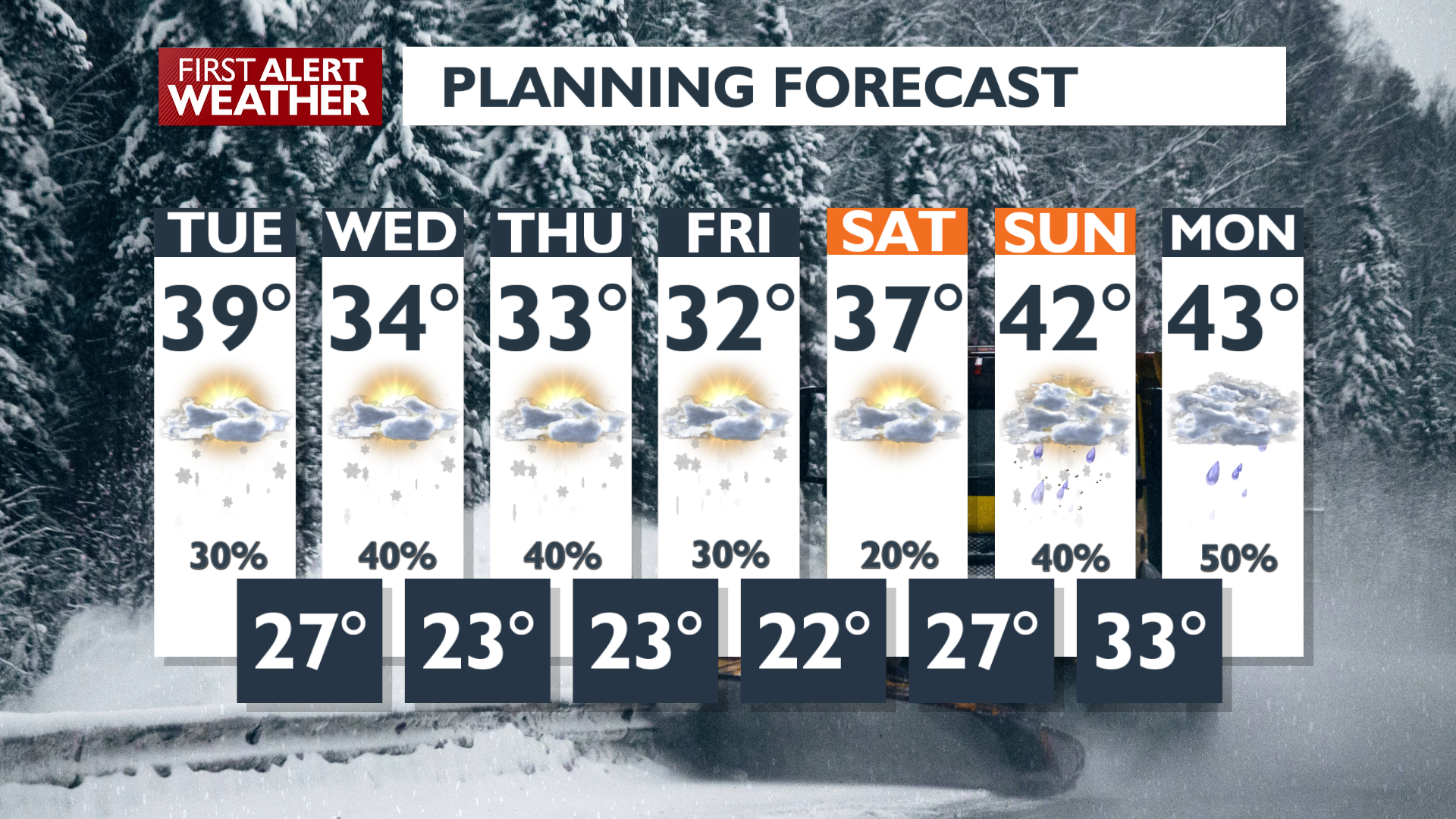
Quick-hitting winter weather is the name of the game for the rest of the week. We’ll see long periods of calm conditions intermixed with brief snowfall that could change travel conditions quickly.
Plan Your Tuesday
Temperatures will reach the mid to upper 30s, and sunshine makes a brief appearance for lunchtime.
By late afternoon, however, showers will develop in Southeast Washington and pinwheel northeast towards Spokane and North Idaho during the evening. These bands of snow could drop a quick inch or two of snow and create some quick-changing road conditions for overnight and early Wednesday morning travel.
What We’re Tracking
This pattern of scattered late PM to early AM snow continues through Friday. Temperatures will continue to cool, with highs only around freezing by the end of the week and lows dropping all the way down to the low 20s.
The pattern shifts again this weekend, warming us up rapidly and turning snow chances to rain chances by early next week.
Extended Forecast
COPYRIGHT 2025 BY KXLY. ALL RIGHTS RESERVED. THIS MATERIAL MAY NOT BE PUBLISHED, BROADCAST, REWRITTEN OR REDISTRIBUTED.