After some dry and beautiful days, it looks like the weather is turning towards what we would expect for February.
Plan Your Friday
Morning fog is possible but not as likely as the last few mornings. It will be a mostly cloudy day with a light breeze out of the southwest. Temperatures will reach the upper 30s and low 40s. Conditions remain dry until the late evening, when light rain is possible around Spokane and Coeur d’Alene. Wet weather continues through the night.
What We’re Tracking
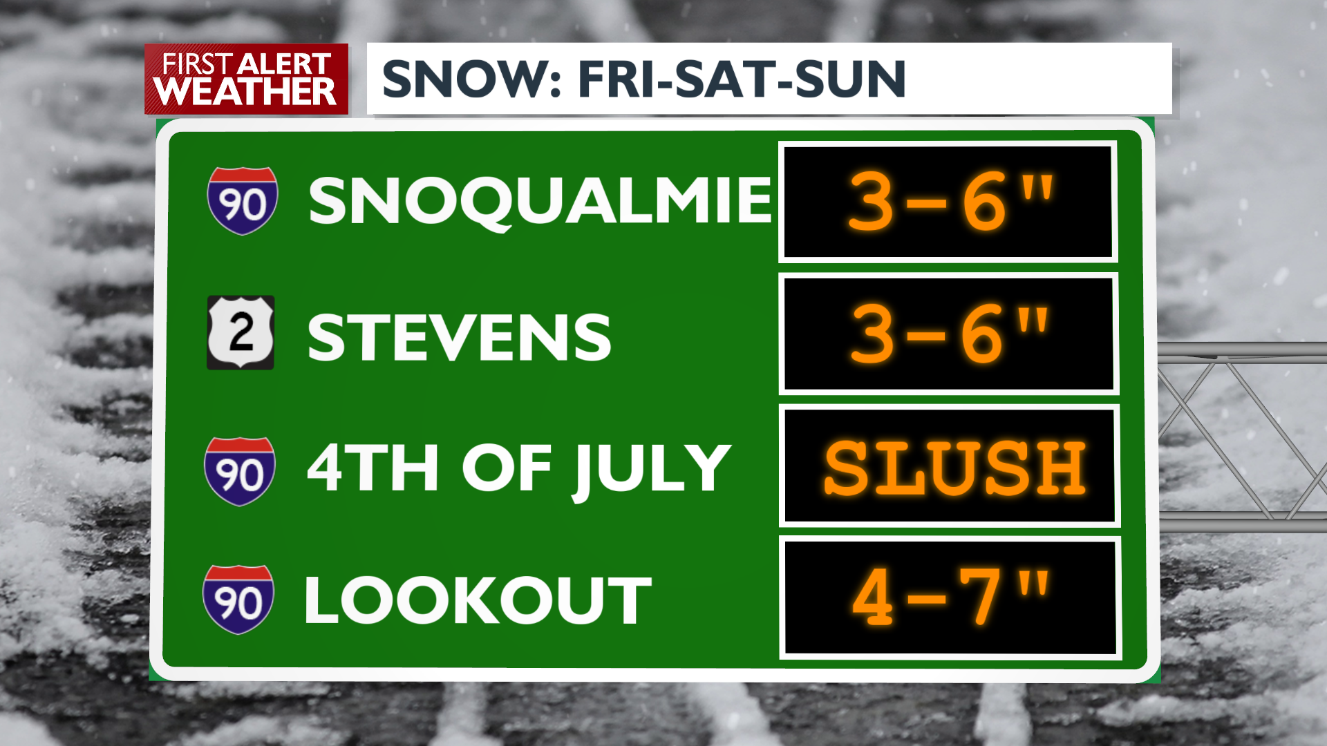
Through the weekend, precipitation stays as rain in the valleys with snow in the mountains and over the passes. Expect it to be wet most of Saturday, especially around Southeast Washington and the central panhandle. The driest part of the day will be the evening, some consolation if you have dinner plans Saturday night.
Sunday will be tamer, with only the occasional light shower as we go in between storm systems for several hours.
The wet weather is back early Monday with a mix of rain and snow for the valleys and lowlands. As the week goes on and more and more cold air gets placed over the Northwest, the odds for valley snow will continue to rise. It’s beginning to look like next week will be the most it’s looked or felt like winter in quite some time.
Extended Forecast
COPYRIGHT 2025 BY KXLY. ALL RIGHTS RESERVED. THIS MATERIAL MAY NOT BE PUBLISHED, BROADCAST, REWRITTEN OR REDISTRIBUTED.