Gloomy skies are here for Friday and the weekend. It will remain dreary and dry today before rain arrives for Saturday and Sunday.
Plan Your Friday
Temperatures will be much colder than earlier this week as a result of the long-lasting fog and persistent cloud cover today. Unlike the last couple of days, it’s highly unlikely we’ll see the sun punch through the clouds. Highs will only be in the upper 30s and low 40s, similar to how Thursday turned out, which will also allow fog to redevelop quickly this evening.
What We’re Tracking
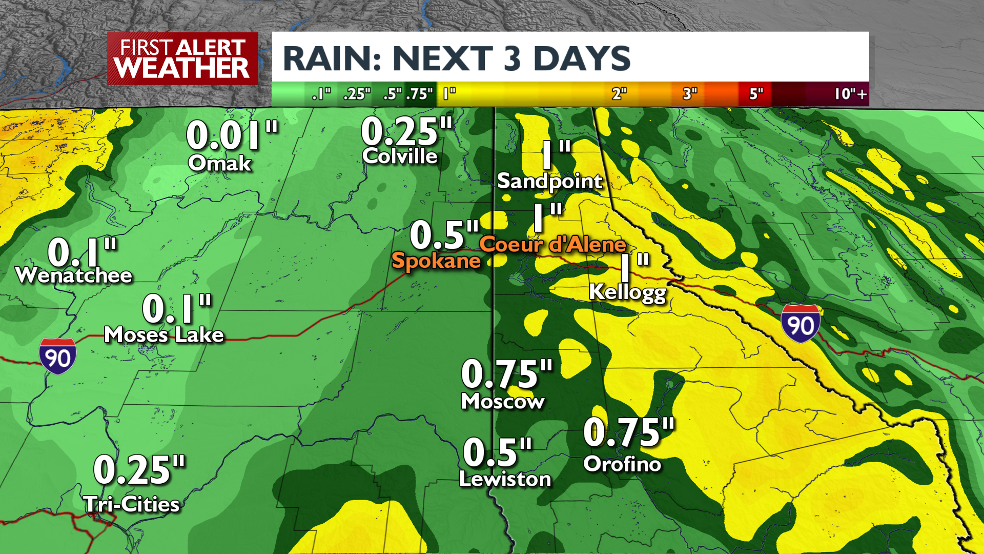
We’ll have more fog and cloudy skies to begin Saturday before the rain arrives. Expect wet weather during the afternoon and evening. There will be a break in the late night and on Sunday morning, before more rain shows up for late Sunday into early Monday morning. Heavy rain totals are possible across North Idaho by the time this system leaves us on Monday.
Snow levels will remain pretty high (5000-6000 feet) until Monday morning when it will be cold enough for a brief rain/snow mix as the system exits our area. Monday morning travel over mountain passes will likely return to winter conditions for the first time in weeks.
Extended Forecast
COPYRIGHT 2025 BY KXLY. ALL RIGHTS RESERVED. THIS MATERIAL MAY NOT BE PUBLISHED, BROADCAST, REWRITTEN OR REDISTRIBUTED.