It’s pretty warm out there for January, and conditions will stay mild until a dry “winter gloom” pattern settles in later this week.
Plan Your Monday
Winds will be breezy today out of the south with gusts of 10 to 20 mph, becoming stronger, up to 20 mph, over the Palouse and eastern Columbia Basin this afternoon before calming this evening. The south wind flow will warm us up to the upper 40s and low 50s in the Columbia Basin. Sky cover will be partly to mostly cloudy. Some occasional drizzle is possible through the day in North Idaho, especially this evening.
What We’re Tracking
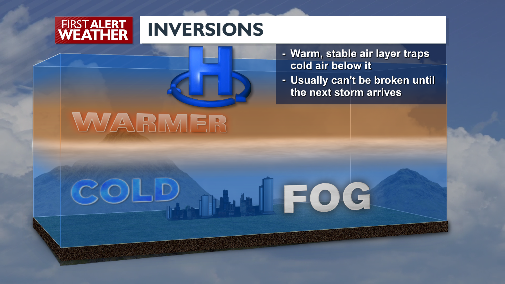
A strong, dry, high-pressure ridge settles in starting Tuesday and is expected to remain the dominant weather feature over us through the entire week and into this weekend. This setup will lead to temperature inversions, low clouds and fog expanding into the northern valleys on Tuesday night. These will spread across much of the region by Wednesday night into Thursday. Temperatures mid-week will be suppressed by the cloud cover, likely only going from the mid-20s in the morning to mid-30s in the afternoon. In other words, the winter gloom will be with us from Wednesday through the weekend, and could still be here well into next week.
Extended Forecast
COPYRIGHT 2025 BY KXLY. ALL RIGHTS RESERVED. THIS MATERIAL MAY NOT BE PUBLISHED, BROADCAST, REWRITTEN OR REDISTRIBUTED.

