Roads will be slick and icy in many areas after last night’s snow. Breezy weather and flurries will keep it feeling like winter today even as we get above freezing this afternoon.
PLAN MY DAY
Expect continued slick road conditions in areas like Spokane as we thaw the sno in the afternoon and turn it to patches of ice in the evening.
Breezy afternoon winds gusting 20 to 30 mph will add a little chill in the air through the day. The Cascades and northern ID mountains will see additional snowfall through this afternoon, potentially adding 8 to 16 inches of snow through early tomorrow morning for the Cascades, with 4 to 7 inches for Lookout Pass. The Winter Storm Warning for the Cascades and Winter Weather Advisory for the Central Panhandle Mountains remain active until 4 PM this afternoon.
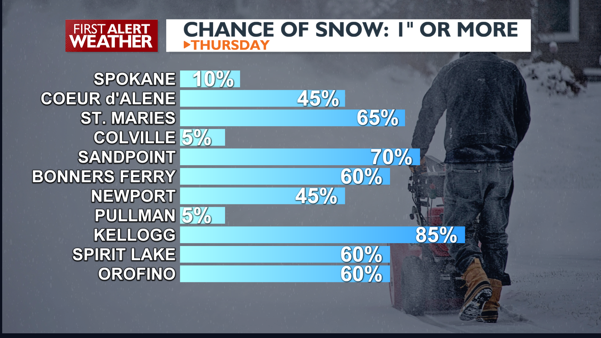
In the valleys, some of this snow will appear occasionally in the afternoon, mainly in North Idaho. Any snow amounts will be considerably lighter than last night, but parts of the central Panhandle could see over an inch.
WHAT WE’RE TRACKING
Conditions shift to drier weather Friday into the weekend as a ridge builds, bringing temperatures up, with highs in the mid 30s to 40s. By Sunday afternoon, chances for light precipitation return. Snow levels will rise to 5000 to 6000 feet, which means Sunday night and Monday we’ll see rain, not snow in the valleys. Temperatures continue to warm into the middle of next week.
EXTENDED FORECAST
COPYRIGHT 2025 BY KXLY. ALL RIGHTS RESERVED. THIS MATERIAL MAY NOT BE PUBLISHED, BROADCAST, REWRITTEN OR REDISTRIBUTED.

