Grab your snow gear this morning. We’ll see snowy weather through the daylight hours on Tuesday followed by some gusty winds after sunset.
Plan Your Tuesday
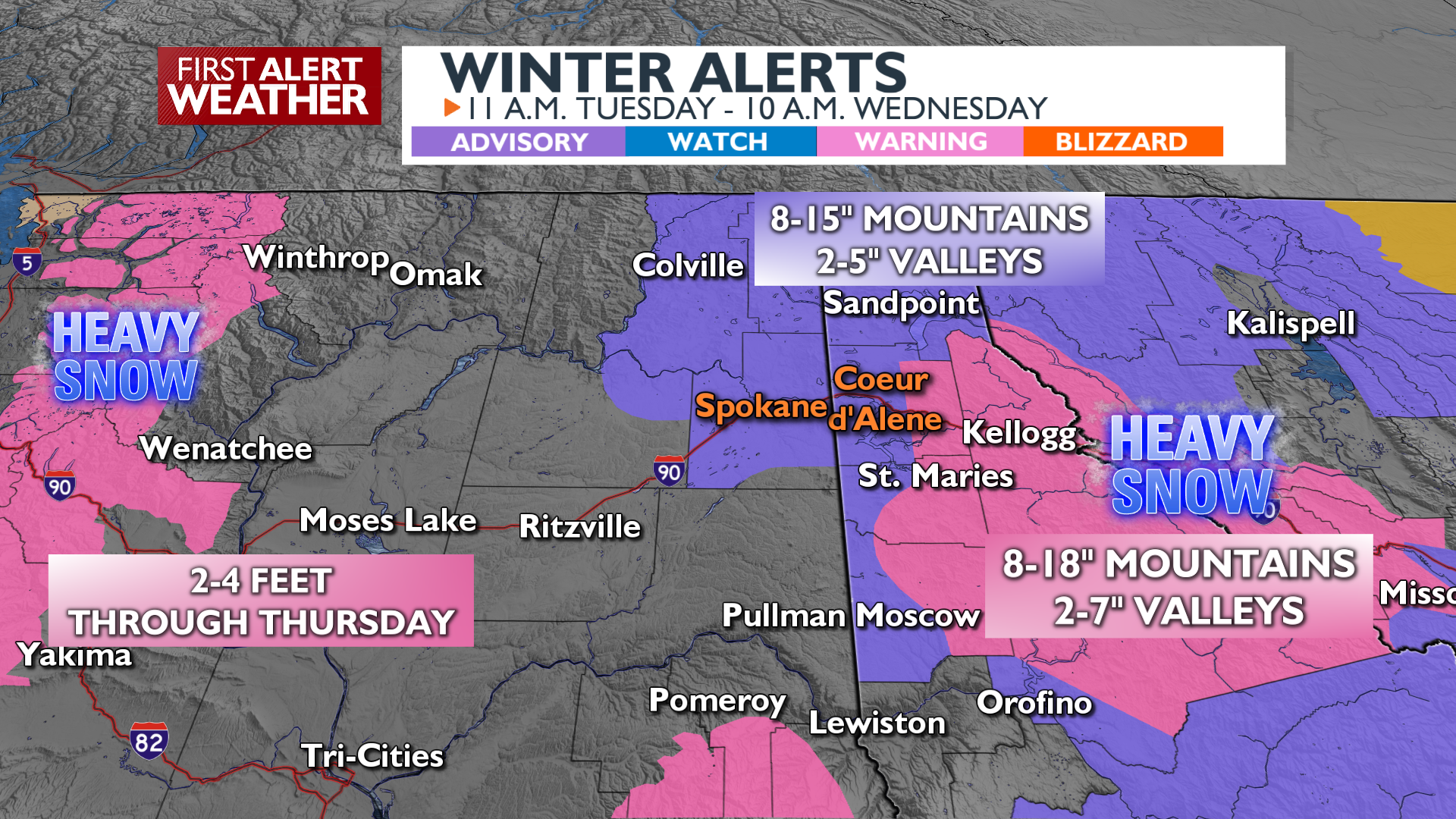
Snow will begin in the middle to late morning and continue to fall into the start of the evening commute. Temperatures will slowly warm above freezing around I-90, which will limit snow totals to between a half-inch and 2 inches depending on your elevation. Further north around Deer Park, Newport, Athol, and Sandpoint/Sagle there will be more snow today, 2-5″. The Silver Valley east of Kellogg will also see heavier snow that could get into the 5-7″ range by the time snow ends late tonight in Shoshone County.
Winds will gust up to 40 mph across the Palouse, Spokane, and Columbia Basin areas tonight behind the snow. Snow may turn to rain briefly in Spokane as the winds pick up and temperatures rise in the evening.
A Closer Look
What We’re Tracking
Wednesday and Thursday will feature afternoon snow showers developing in North Idaho and Northeast Washington while the Columbia Basin and Spokane only see occasional snow. Snow is most likely for the I-90 metro Wednesday evening. High pressure takes over for the weekend with dry skies, chilly mornings and warm afternoons.
Extended Forecast
COPYRIGHT 2025 BY KXLY. ALL RIGHTS RESERVED. THIS MATERIAL MAY NOT BE PUBLISHED, BROADCAST, REWRITTEN OR REDISTRIBUTED.