Heavy mountain snow and gusty winds impact our mountains through the end of the week with Winter Weather Advisories in effect for several areas.
Plan your Thursday
We’ll begin the day with light snow or a rain/snow mix moving in depending on your elevation. Many people will see snow, but few will see it actually accumulate. Parts of the central Idaho Panhandle, Okanogan Highlands, Methow Valley, Priest Lake, and along the Canada border will see the snow stick today.
Temperatures will start out close to freezing and rise through the day, hitting the mid 40s late this evening.
Gusty winds will arrive tonight, but will only gust to 40 mph; not nearly as strong as the windstorm we just had on Wednesday.
What We’re Tracking
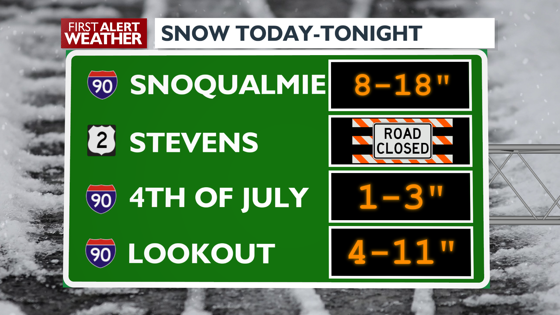
Heavy snow will continue tonight and tomorrow in the Cascades and North Idaho mountains. Travel will be difficult at times over Snoqualmie Pass and Lookout Pass. Sunshine on Friday will be followed by occasional snow showers this weekend. Highs will remain warmer than usual, in the upper 30s through Sunday.
🚨Weather Alert: Flood Watch for the city of Moscow. Paradise Creek is expected to hit minor flood stage early Friday morning, sending water out of its banks in the northeastern part of the city.
Extended Forecast
COPYRIGHT 2025 BY KXLY. ALL RIGHTS RESERVED. THIS MATERIAL MAY NOT BE PUBLISHED, BROADCAST, REWRITTEN OR REDISTRIBUTED.