Heavy mountain rain will continue to create flooding in North Idaho and the Washington Cascades today. Elsewhere, another round of strong winds is expected across the region.
Plan your Wednesday
Valleys and lowlands in Eastern Washington will only see occasional showers today, but heavy rain will continue in the Cascades and the Idaho Panhandle.
Snow levels are very high, rising to 7500-9000 feet this morning, which will contribute to snowmelt and increase runoff into rivers.
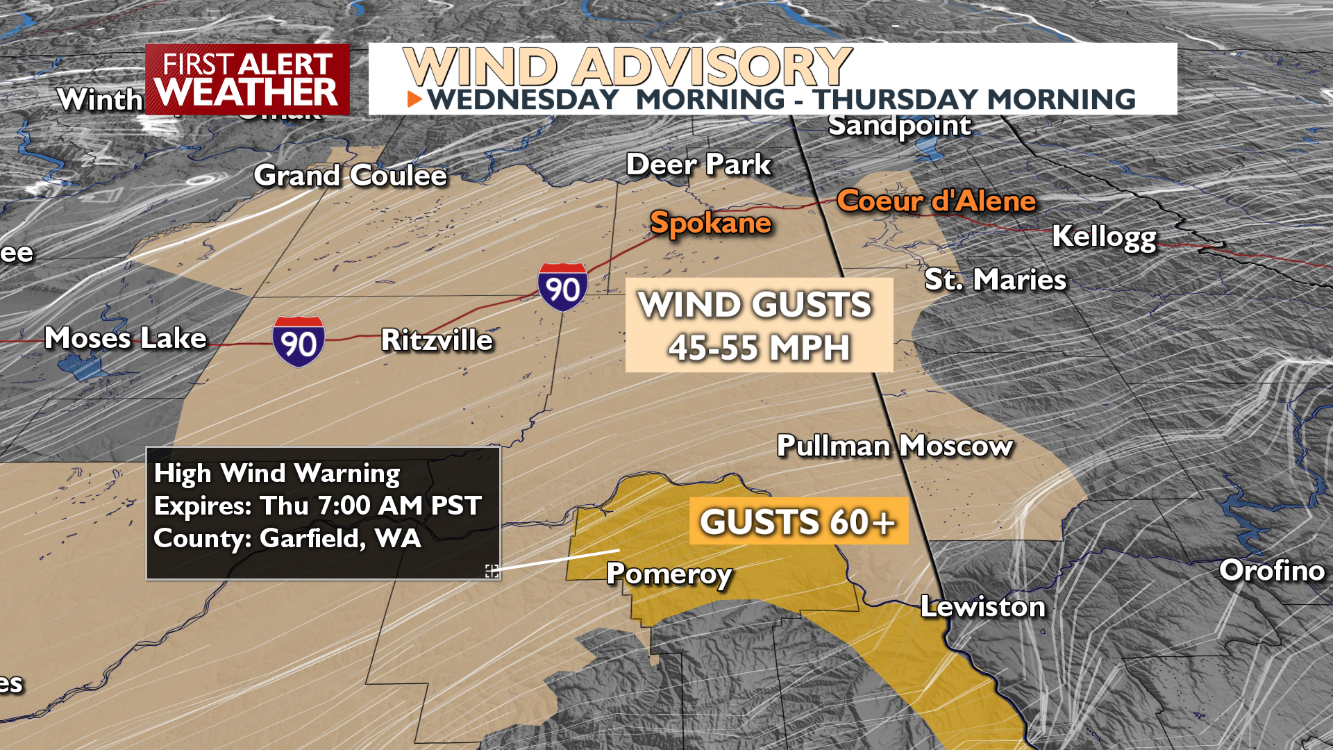
Winds will be strong across Eastern Washington, with sustained speeds of 25-35 MPH and gusts up to 55 MPH for the Spokane/Coeur d’Alene area. A Wind Advisory is in effect.
High temperatures this period will be very mild, reaching the mid 50s to mid 60s in many areas, which is 20 to 25 degrees above normal. Spokane will approach record highs the next two days, but we are not forecasting those records to be broken at this point.
What We’re Tracking
The main weather concern through Thursday is the additional heavy mountain rain, which brings the threat of flooding along area rivers. We are also watching for potential rock and mud slides in steep terrain, especially near recent burn scars. For the Idaho Panhandle, the St. Joe and Coeur d’Alene Rivers are areas of concern as they hit flood stage tonight or on Thursday. In the Cascades, the Wenatchee, Yakima, and Entiat rivers will all experience flooding coming off of the east slopes of the range.
We’ll see dry weather this weekend, but another round of precipitation is possible for Sunday night into Monday, though likely less impactful than the current storm.
Extended Forecast
COPYRIGHT 2025 BY KXLY. ALL RIGHTS RESERVED. THIS MATERIAL MAY NOT BE PUBLISHED, BROADCAST, REWRITTEN OR REDISTRIBUTED.