Monday will be gusty and sunny before a cold night and the next round of impactful travel weather on Tuesday.
Plan your Monday
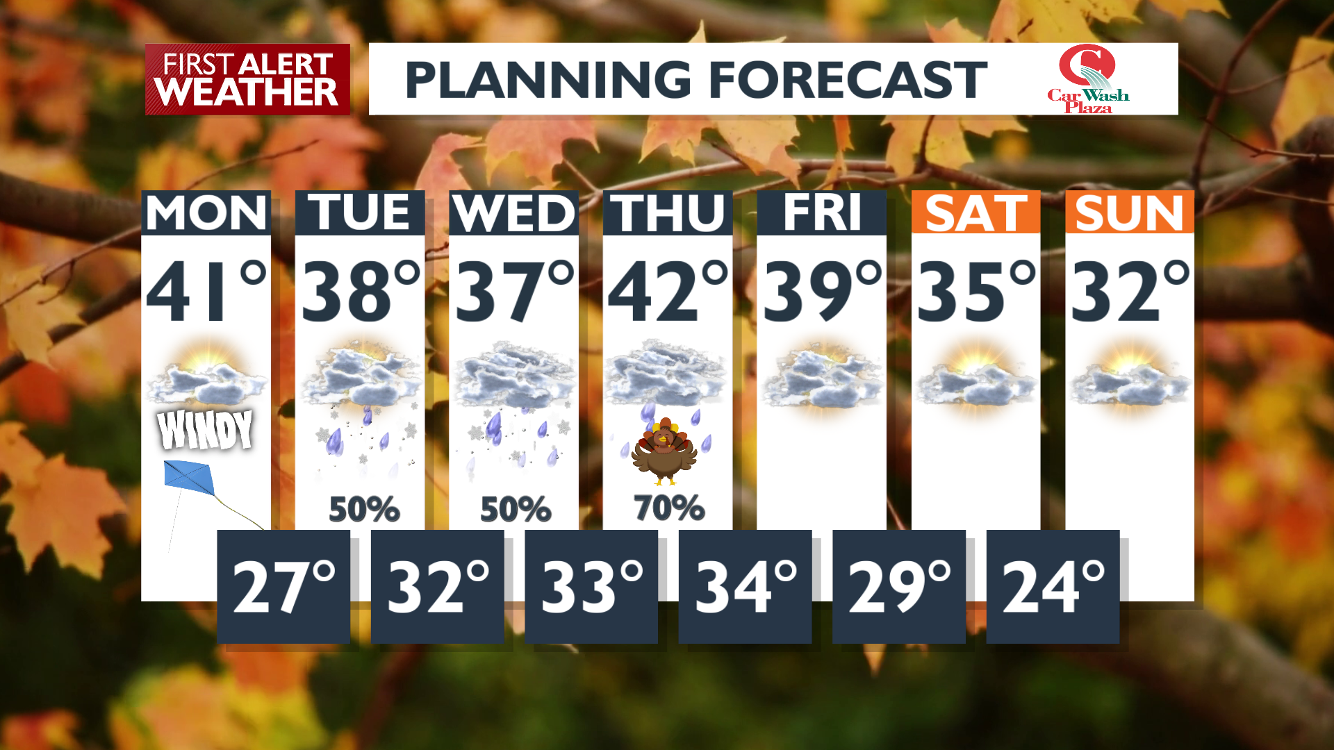
It will be a windy day with gusts reaching 30 mph, with localized higher gusts near 35 to 40 mph around the Blue Mountains and the Palouse. Sunshine will stick around through the rest of the day. The clear conditions will cause temperatures to drop fast this evening, and lows will be in the 20s tonight for the first time in a while.
What We’re Tracking
The pattern becomes active again later this week with snow over the mountain passes starting Tuesday night into Wednesday. There is a chance for lowland snow Tuesday night into Wednesday morning. Exact amounts will vary from north to south and by elevation, but in general, total snow of 1 inch or less (mostly less) is the most likely scenario from I-90 to the international border.
Snow in the mountains will be much heavier and impact holiday travel, especially on Tuesday night into Wednesday morning. If you can, avoid travel across the Cascades and Lookout Pass from midday Tuesday through Wednesday morning. Cooler air filtering in from the north is expected by the end of the week, with chilly temperatures this weekend.
Extended Forecast
COPYRIGHT 2025 BY KXLY. ALL RIGHTS RESERVED. THIS MATERIAL MAY NOT BE PUBLISHED, BROADCAST, REWRITTEN OR REDISTRIBUTED.