Don’t leave home without some rain gear. It’s going to be a wet and windy finish to Wednesday.
Plan Your Wednesday
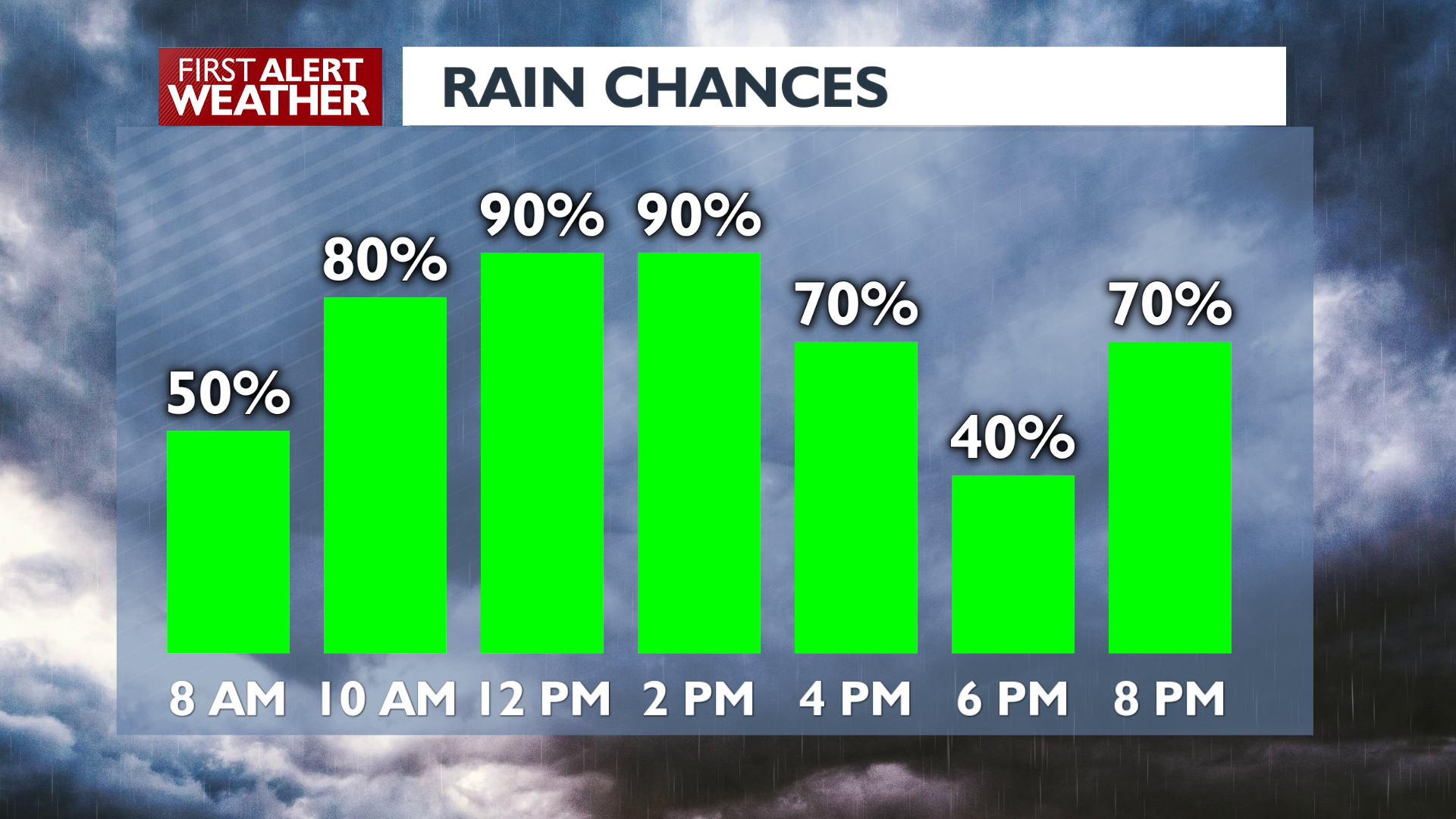
Widespread rain continues across the region later morning as an occluded low passes by the coast. Steady rain will fall in the late morning and midday ahead of a cold front that will pass this afternoon. As the front moves through winds will shift, bringing gusts up to 35 mph to the Columbia Basin and Palouse. There is a chance for a couple of thunderstorms in southeastern Washington as the front comes through, so anyone in the Palouse or Blue Mountains regions might get a triple threat of heavy rain, wind, and lightning for several minutes today. Rain coverage starts going down after dinnertime while winds remain blustery.
What We’re Tracking
After Wednesday we’ll have seen two out of the three systems we expected this workweek. Storm number three brings widespread rain Thursday afternoon and evening. Snow levels drop to between 5000 and 7000 feet, which means we’ll have to watch for snow impacts over Stevens Pass in the Cascades. The weekend looks calmer with stable conditions. As is often the case this time of the year, we’ll start each morning in these conditions with low clouds and fog and see some partial clearing in the afternoon.
Extended Forecast
COPYRIGHT 2025 BY KXLY. ALL RIGHTS RESERVED. THIS MATERIAL MAY NOT BE PUBLISHED, BROADCAST, REWRITTEN OR REDISTRIBUTED.