Our weather stays dry for Thursday before conditions begin to turn tomorrow. Wet weather will begin on Friday, starting in the Cascades and spreading east.
What We’re Tracking
Today: Skies will be partly to mostly cloudy as wet weather approaches the West Coast. Temperatures will be slightly cooler with more consistent clouds but will still be above average in the upper 50s and low 60s.
Tomorrow: Rain begins in the Cascades during the morning with light showers in our western communities. Rain arrives in the Spokane and Coeur d’Alene area in the late afternoon and continues through the evening.
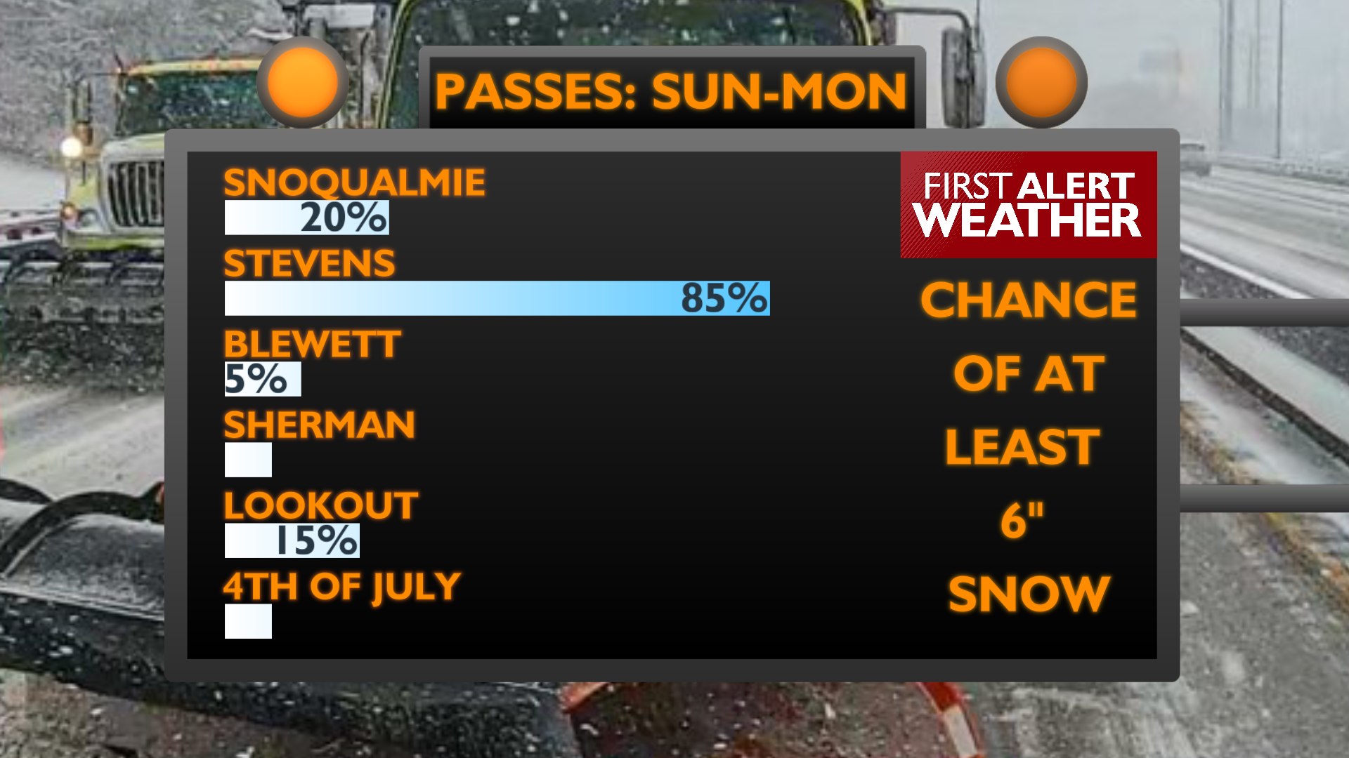
This Weekend: We’ll see long periods of moderate rainfall with a few hours of damp and breezy conditions in between. Gusty conditions may limit how much rain we see in Central Washington. Temperatures will be cool with highs only in the 40s. Expect snow to start falling on mountain passes on Sunday morning. Snow in the North Cascades could cause significant travel disruptions for this early in the season.
Plan your Thursday
Extended Forecast
COPYRIGHT 2025 BY KXLY. ALL RIGHTS RESERVED. THIS MATERIAL MAY NOT BE PUBLISHED, BROADCAST, REWRITTEN OR REDISTRIBUTED.