Cooler weather is coming soon, but for most of us, it won’t be today. Even with building clouds, temperatures approach records again in the afternoon ahead of a slew of changes for midweek.
What We’re Tracking
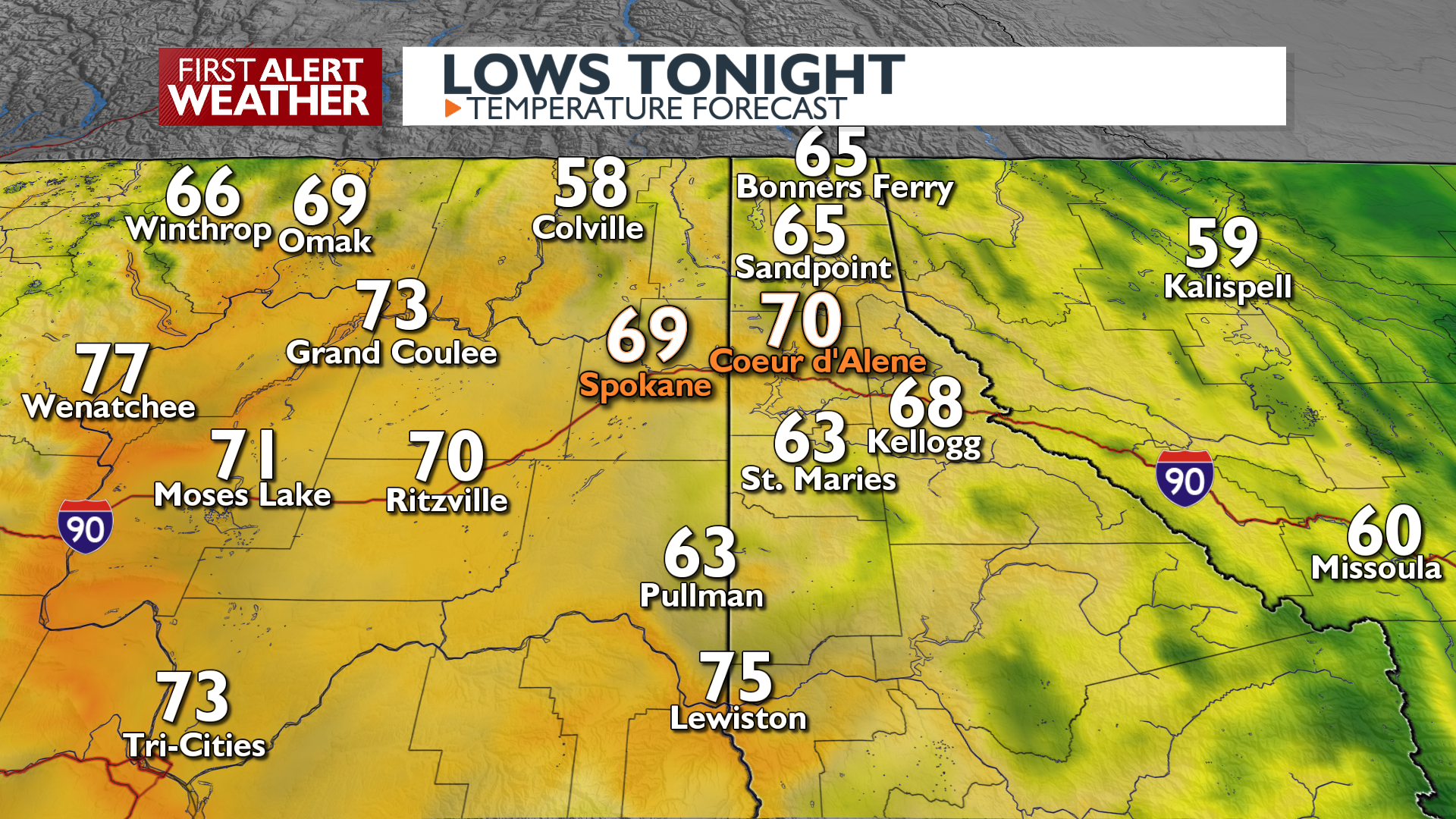
A thick cloud layer this morning will likely keep us away from record heat, but it will still be hot (low to mid 90s)Winds will shift overnight, bringing in more clouds, humidity, and some smoke from OregonTemperatures tonight will be extremely warm; many may not cool below 70 degreesTemperatures cool on Wednesday, upper 80s and low 90sIsolated thunderstorms are possible late Wednesday around the regionMuch cooler Thursday, more isolated rain and stormsAn unsettled pattern of small daily storm chances is likely into the start of Labor Day weekend, with a storm off the NW coast
Plan your Tuesday
Extended Forecast
COPYRIGHT 2025 BY KXLY. ALL RIGHTS RESERVED. THIS MATERIAL MAY NOT BE PUBLISHED, BROADCAST, REWRITTEN OR REDISTRIBUTED.