We’re not quite done with thunder and rain yet. More showers and storms will develop around the Inland Northwest on Friday. We’ll get to relax a little once the weekend arrives.
What We’re Tracking
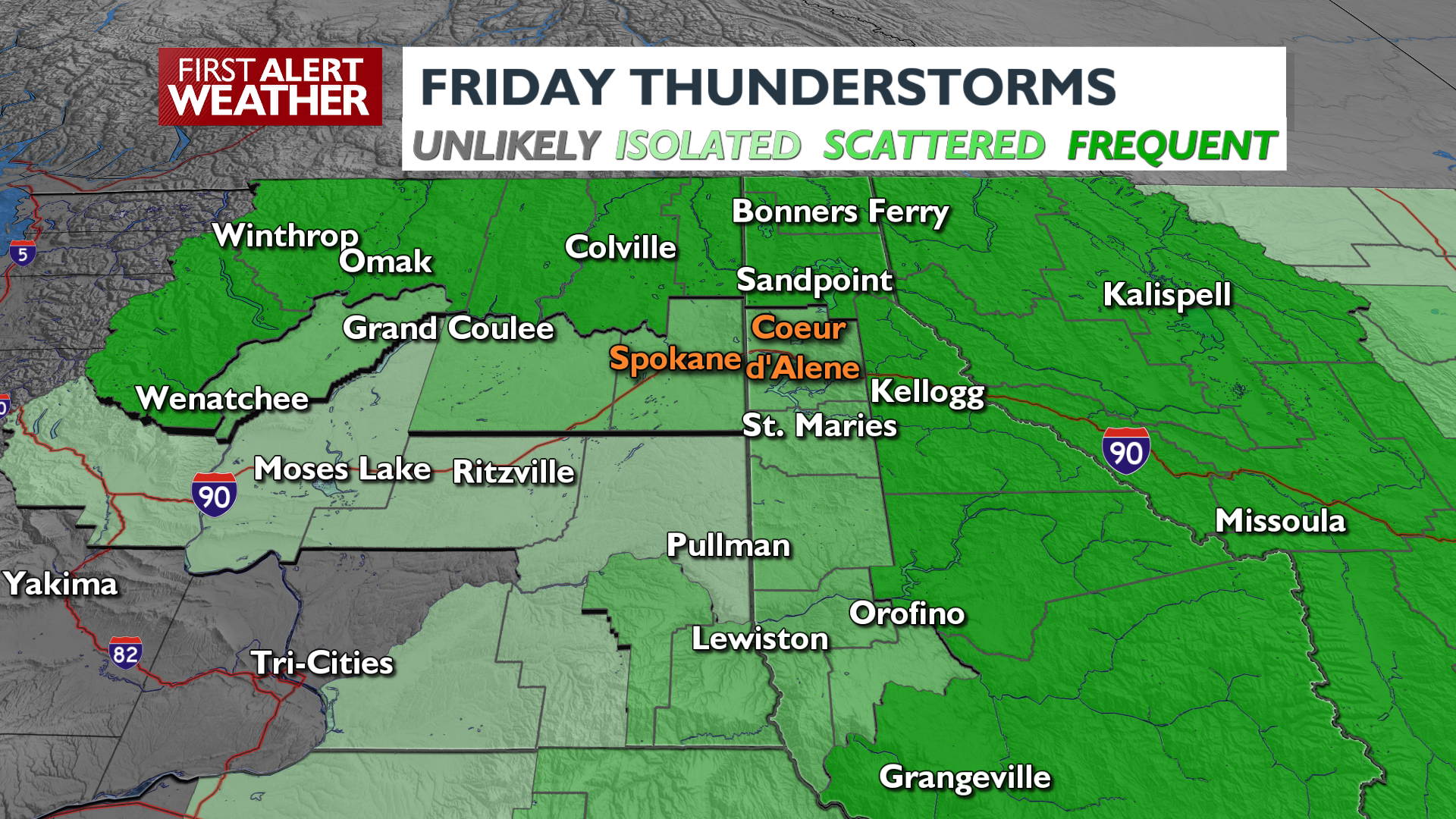
Thunderstorms develop midday around the Cascades, the Canada border, and the Idaho-Montana state lineStorms will track through Northeast Washington and the northern Idaho Panhandle through the afternoon and eveningFlash Flood Watch for wildfire burn scars in Northeast Washington. Stay weather-aware in these areasThe most likely time for storms in Spokane and Coeur d’Alene will be from 3-8 p.m., but coverage will be spotty, similar to Wednesday and ThursdayStray showers and isolated thunder are possible as late as midnightA nice weekend with average highs in the upper 80s and a good amount of sunshineA few more storms are possible on MondayTemperatures next week will be much cooler; highs in the low 80s
Plan your Friday + Weekend
Extended Forecast
COPYRIGHT 2025 BY KXLY. ALL RIGHTS RESERVED. THIS MATERIAL MAY NOT BE PUBLISHED, BROADCAST, REWRITTEN OR REDISTRIBUTED.