The sun popped out to say hello on Saturday, but we won’t be as lucky to end the weekend. Mountain passes will take another big hit from snow while we start off with rain in the valleys and lowlands. As cooler air arrives Sunday night, some of us will pick up some snow before the Monday morning drive.
What We’re Tracking
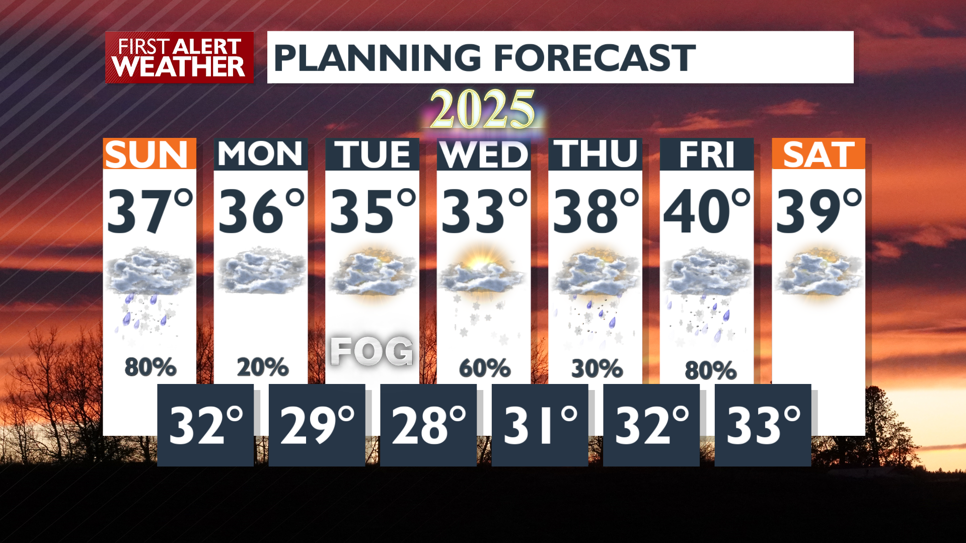
Wet weather moves south to north through Sunday morning, sticks around the rest of the dayAs the storm pushes east, temperatures will cool and rain will turn to snow overnightMost of the snow will be across North Idaho: widespread 1-2″ with the potential for more around the St. Joe River and Silver ValleySnow totals around 1 foot for Lookout Pass Sunday – Monday, use cautionBreezy Sunday night and Monday, but not as strong as other recent stormsWeather calms Monday and Tuesday, but picks up again New Years Day with a chance for snow showers
Plan your Sunday
Extended Forecast
COPYRIGHT 2024 BY KXLY. ALL RIGHTS RESERVED. THIS MATERIAL MAY NOT BE PUBLISHED, BROADCAST, REWRITTEN OR REDISTRIBUTED.

